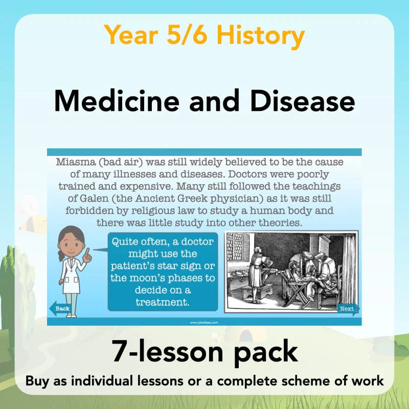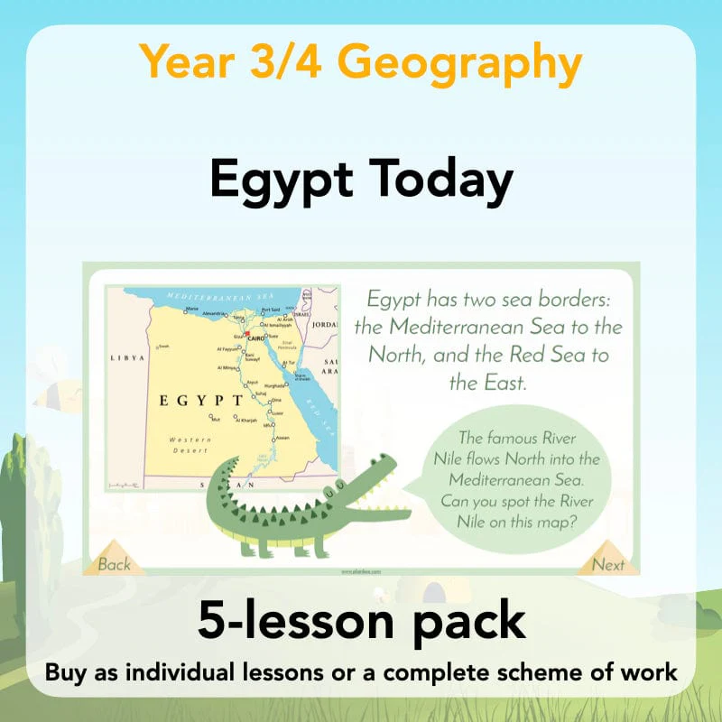
Egypt Today
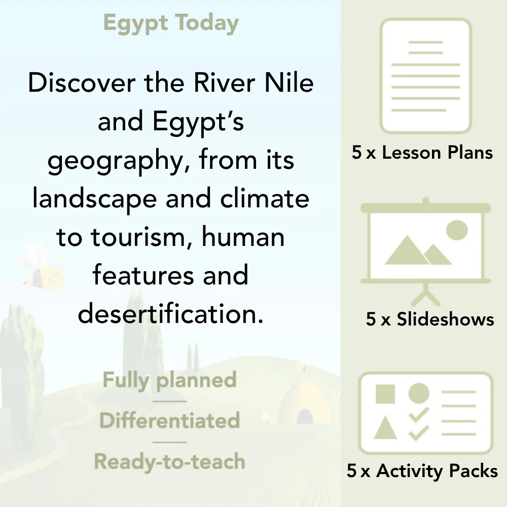
Investigate the home of the famous River Nile in this five-lesson Geography scheme for Year 3 and Year 4. The lessons guide your class through exploring the fascinating landscape and climate of Egypt, including how the River Nile was, and still is, a lifeline for the people who live in Egypt.
In these lessons your class will discuss the human and physical features of Egypt, how tourism affects a country and why they would encourage tourists to visit as well as the causes and effects of desertification on an area. With everything you need to teach about the geography of Egypt, this scheme is a fantastic complement to a topic on Ancient Egypt.
You may also like our Ancient Egyptians Topic Bundle which has four fully-prepared schemes of work all themed around ancient Egypt!
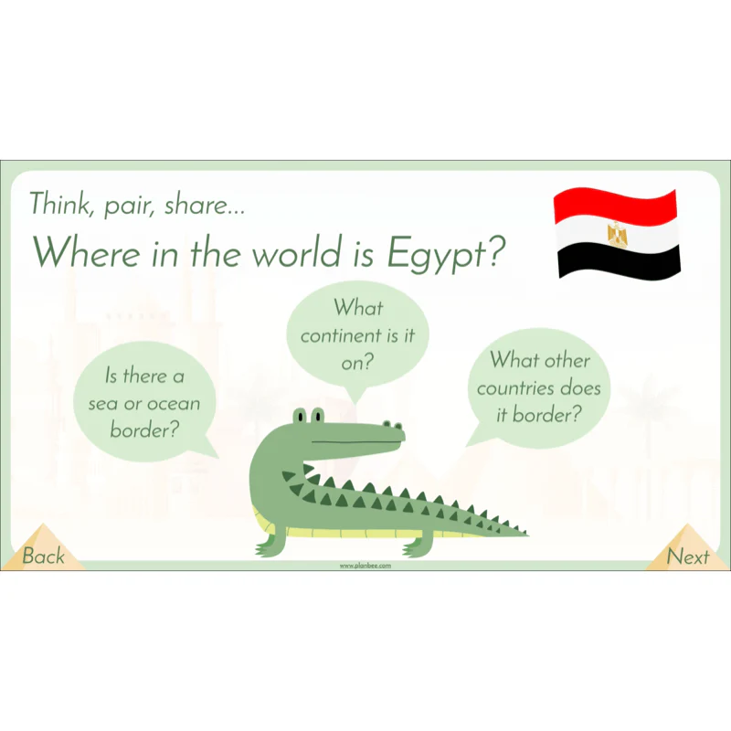
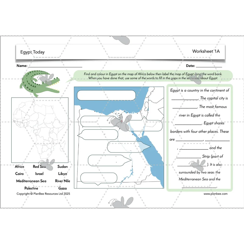
Where is Egypt?
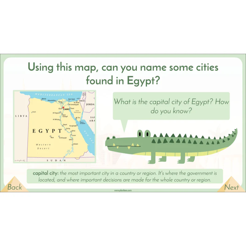
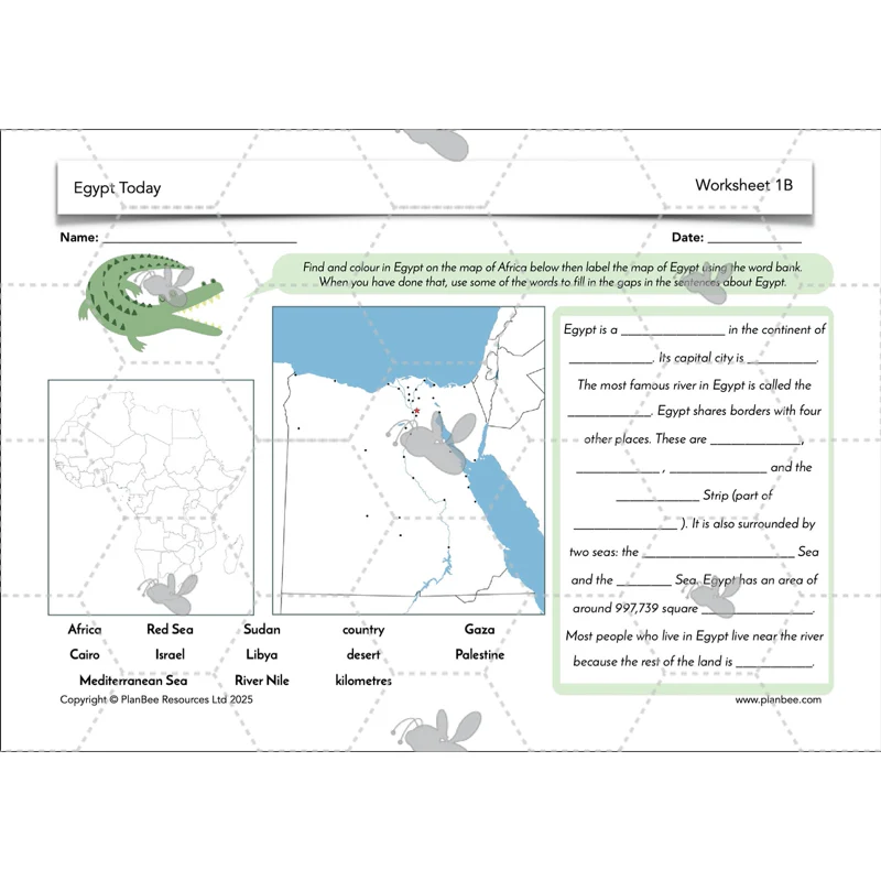
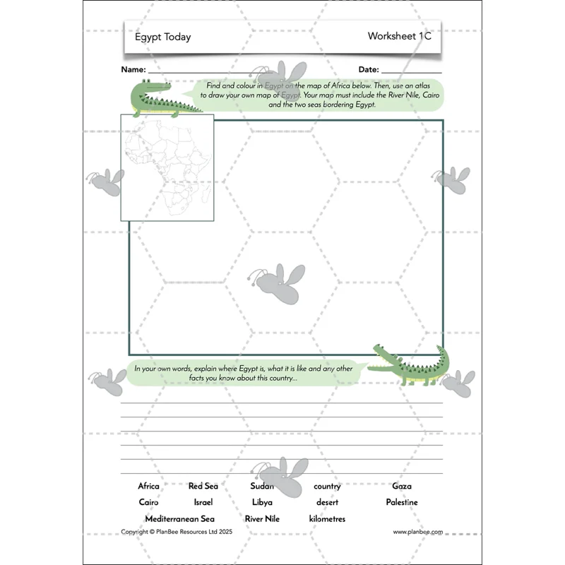
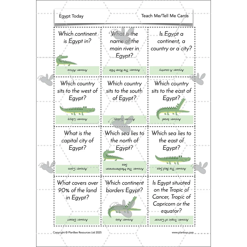
Can you locate Egypt on a map? This lesson focuses on the location of Egypt and encourages your class to use digital and physical maps to gain an understanding of where this country is in the world.
Children will then use existing maps to help them create their own map of the country, including physical features such as the River Nile and sea borders. Alternatively, the children will practise retrieval as they play Teach Me/Tell Me using facts learnt during the lesson.
This lesson comes complete with a detailed lesson plan, lesson slides and all the printable resources you'll need to support your class as they work independently.
What's included:
- Lesson plan
- Slides
- Activity ideas
- Differentiated worksheets
- Teach Me/Tell Me cards
- Teach Me/Tell Me cards teacher notes
- Blank fact cards
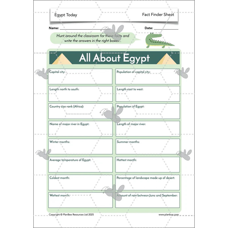
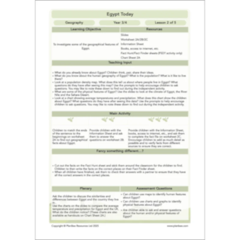
Features of Egypt
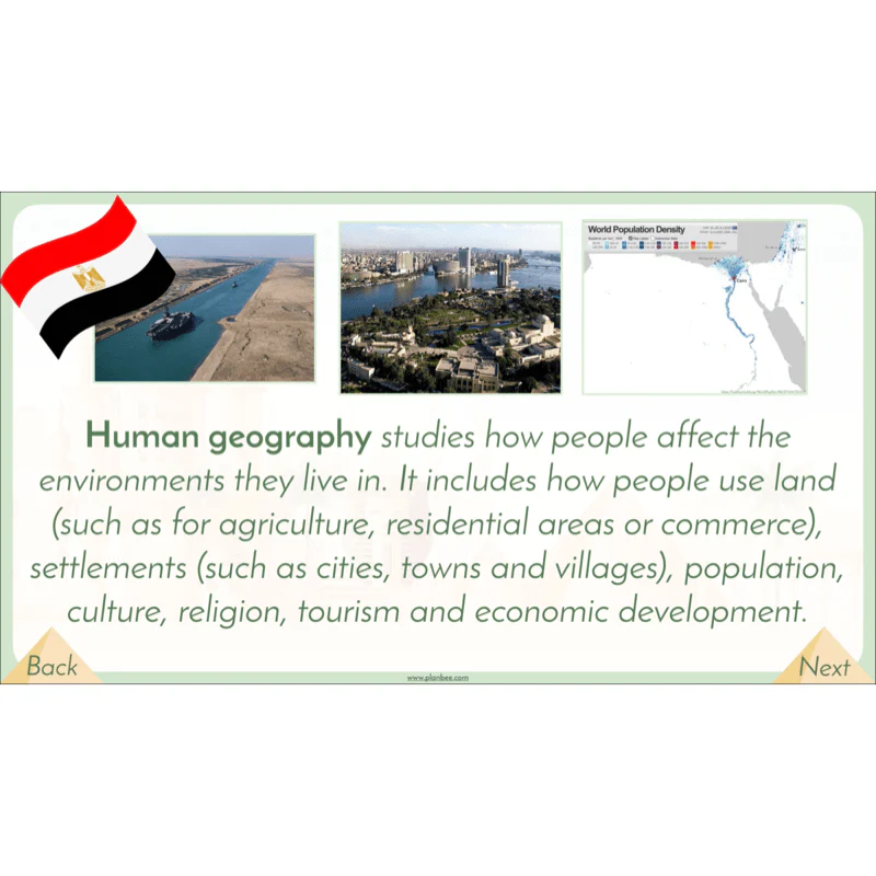
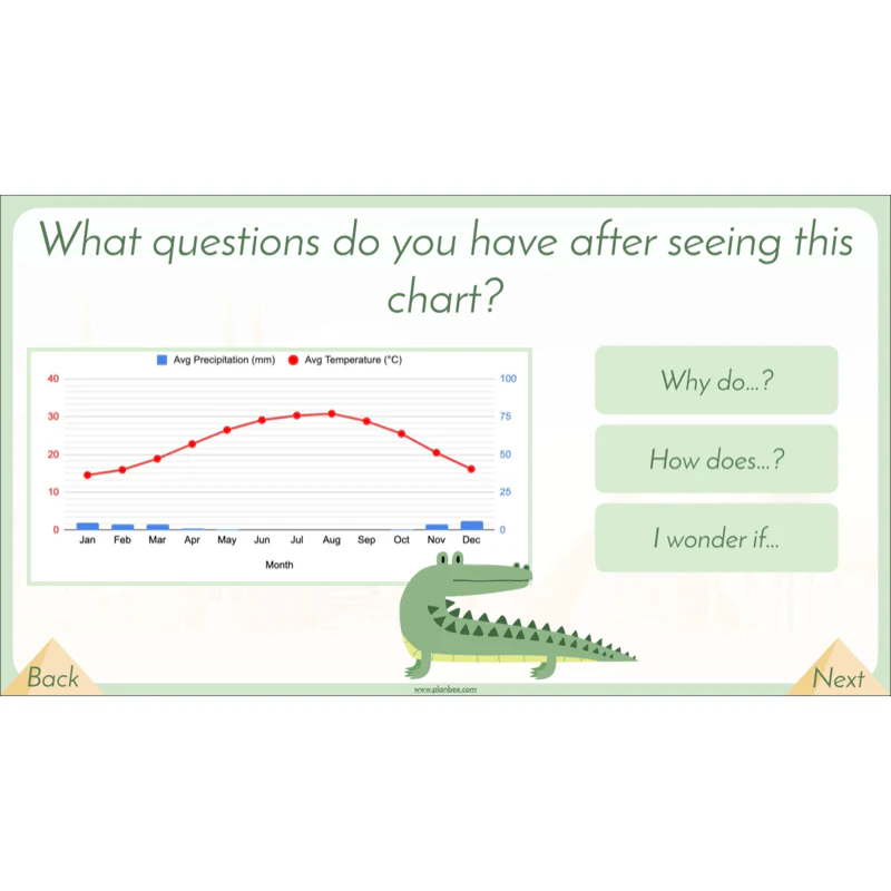
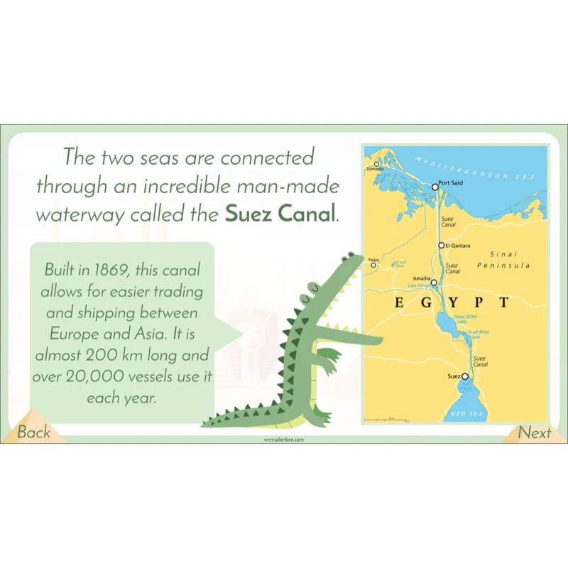
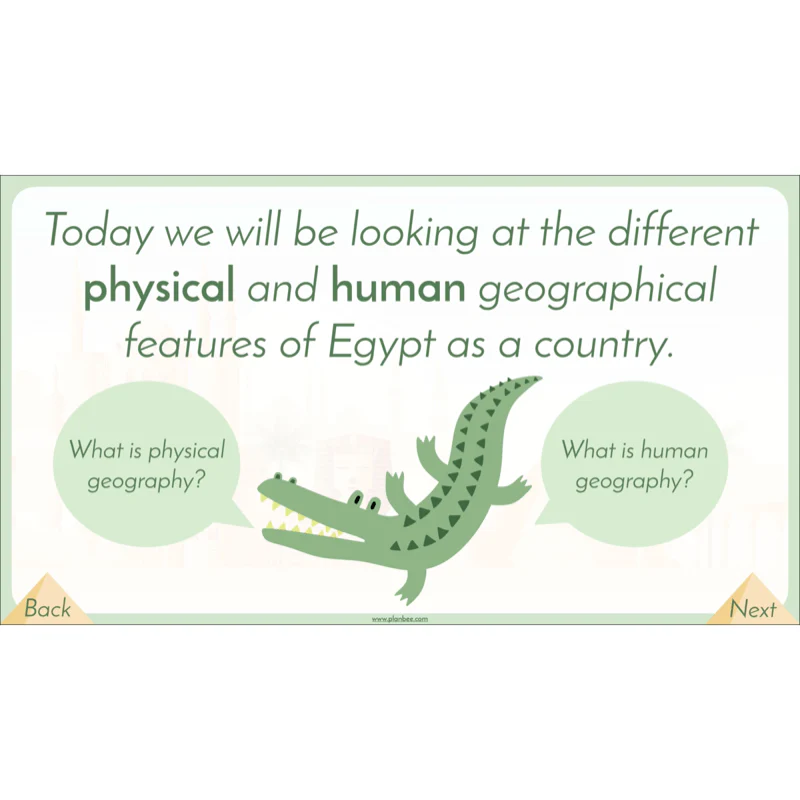
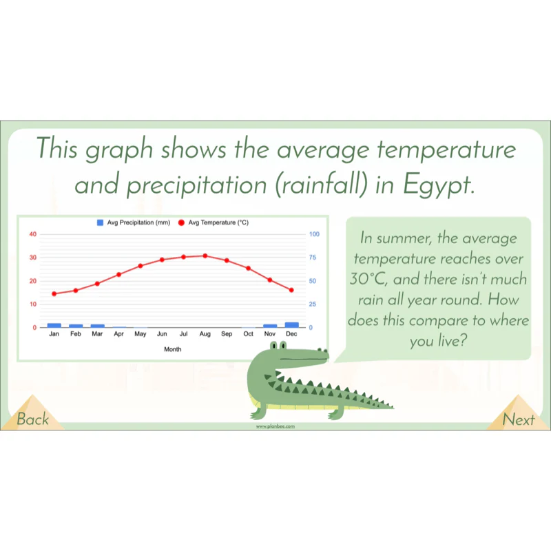
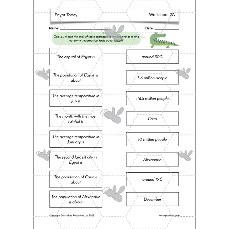
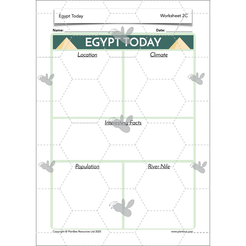
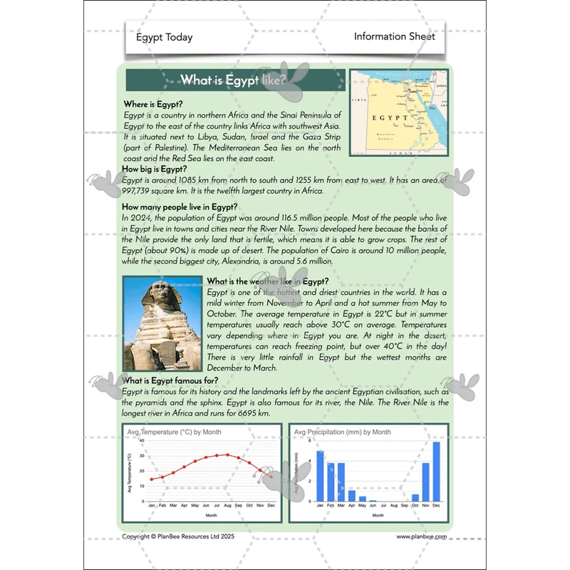
After an overview of Egypt and some of its features in the previous lesson, the children will be challenged to gain a deeper understanding of the human and physical features of Egypt through map study and data charts. They are encouraged to ask and answer questions when presented with geographical data about Egypt.
The children will be presented with different facts that they have to interpret and use to answer questions about Egypt in their independent work.
This lesson comes with all the printable resources you'll need as well as a detailed lesson plan, PDF lesson slides and differentiated activity ideas.
What's included:
- Lesson plan
- Slides
- Activity ideas
- Differentiated worksheets
- Information sheet
- Fact hunt sheets
- Chart sheet
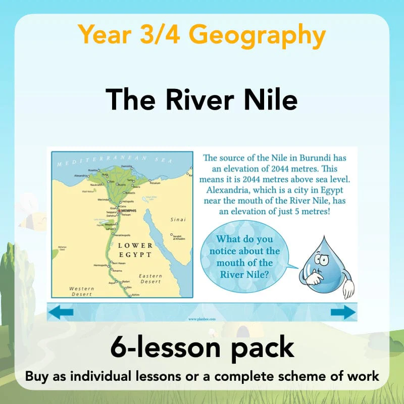
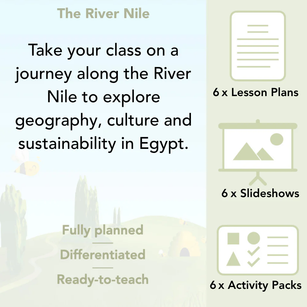
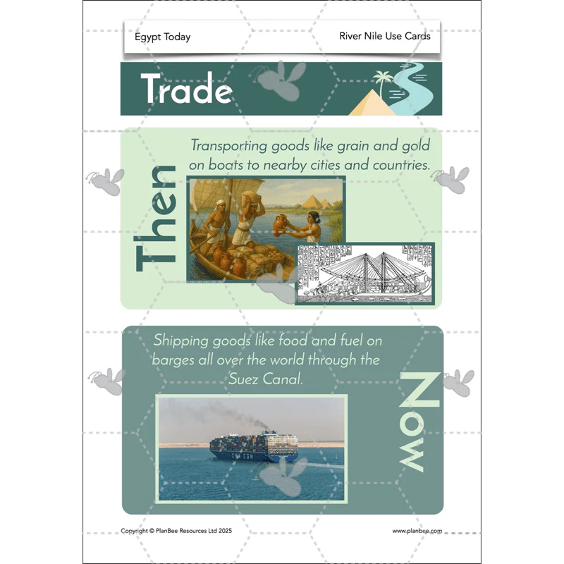
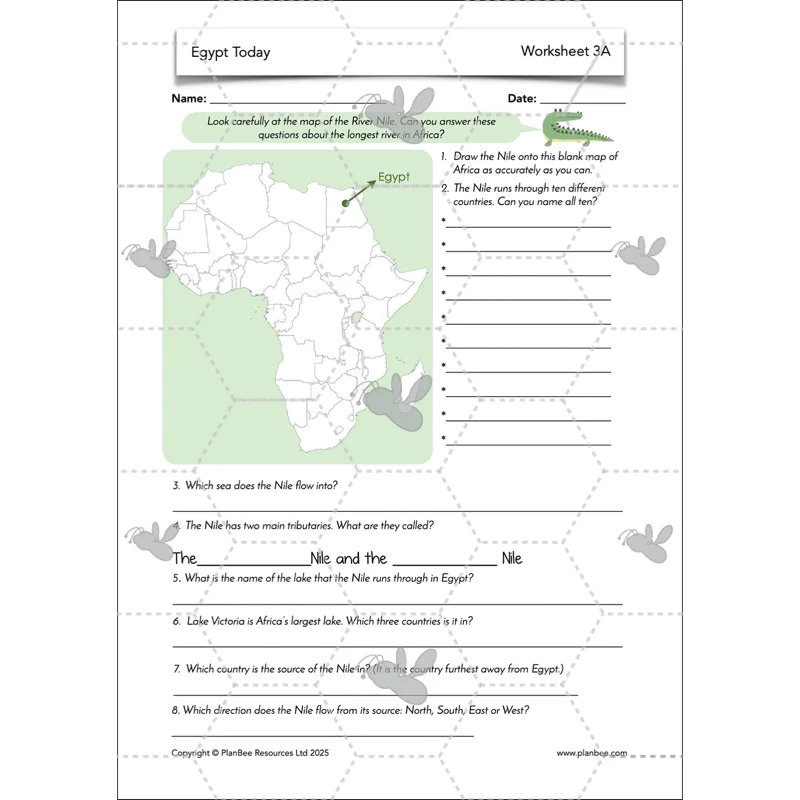
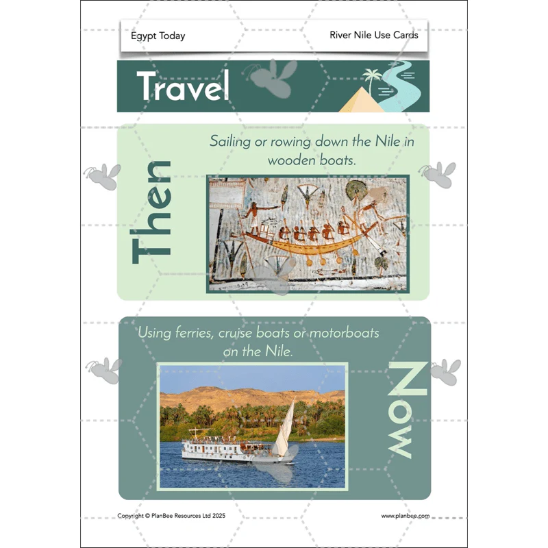
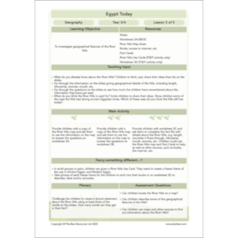
The River Nile
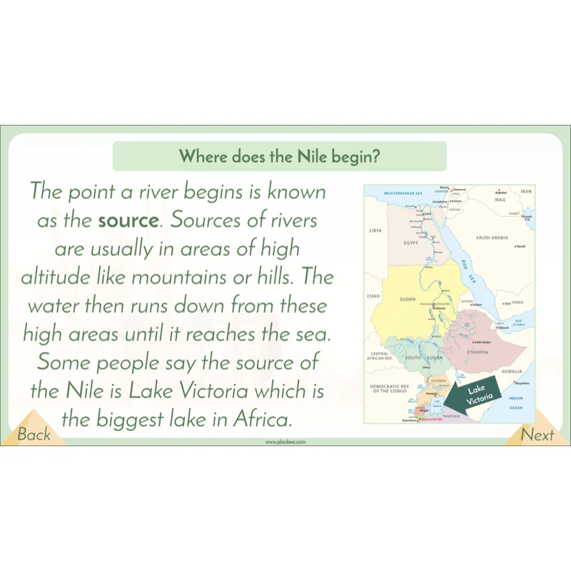
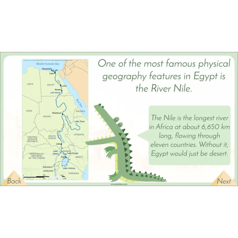
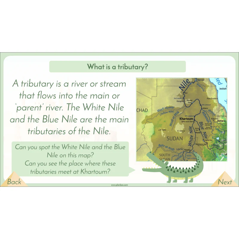
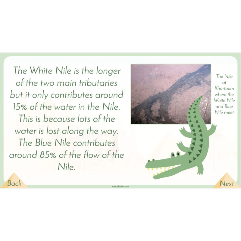
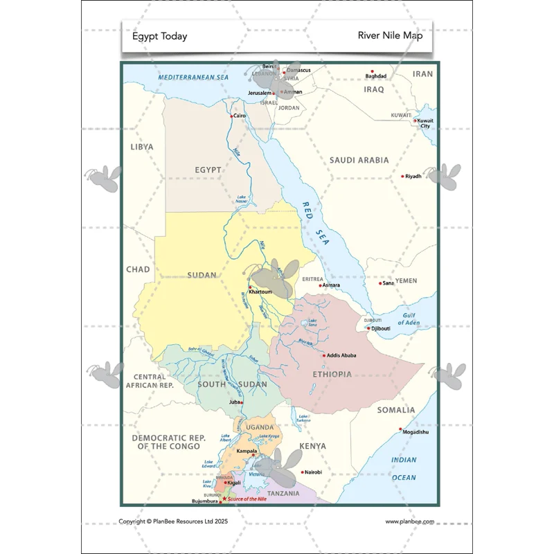
Teach your class about the longest river in Africa as they investigate the geographical features of the River Nile, such as length, tributaries, source and mouth, as well as looking at which countries besides Egypt the Nile runs through.
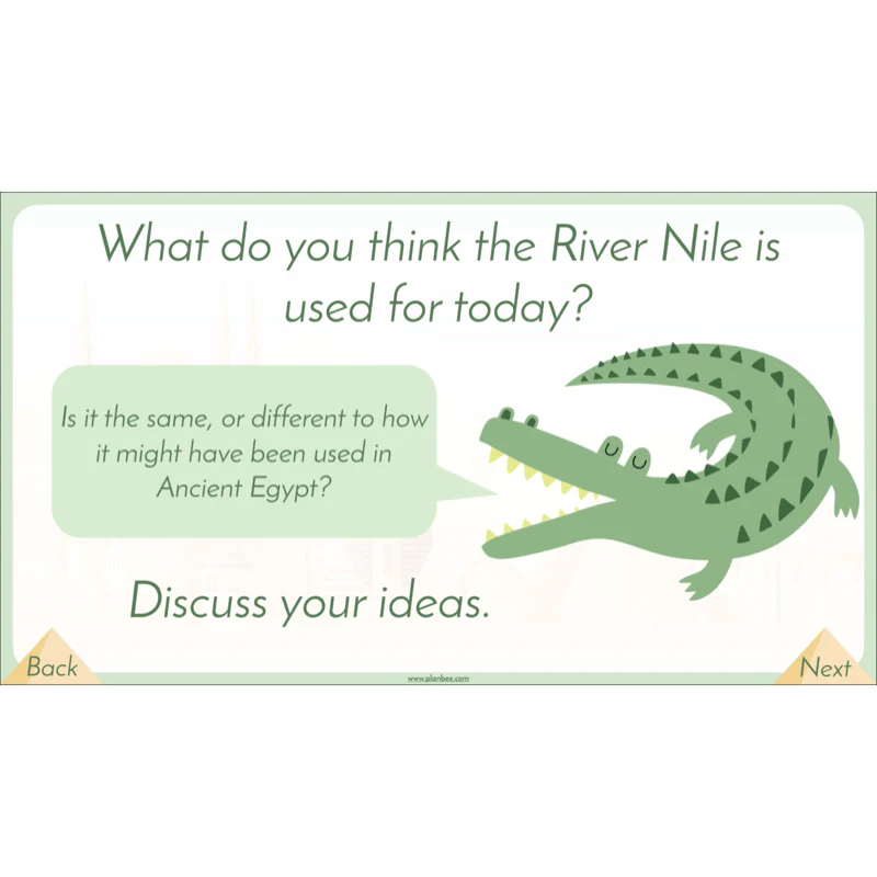
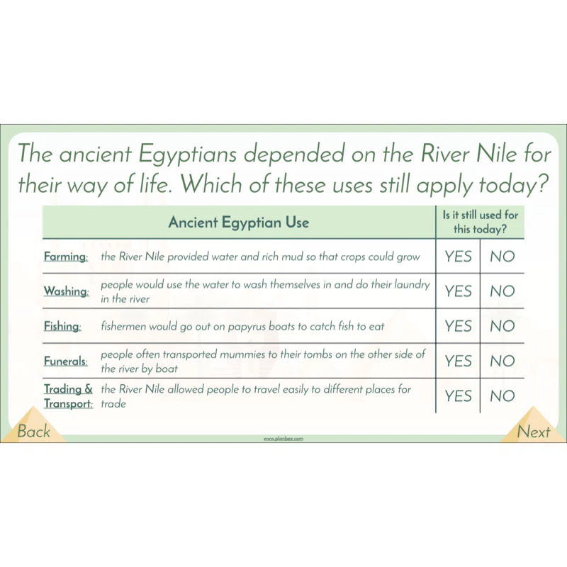
Children will use the provided map to identify the route of the River Nile through Africa. Alternatively the children will investigate how the River Nile is used today and compare this to how it might have been used in Ancient Egypt.
What's included:
- Lesson plan
- Slides
- Activity ideas
- Differentiated worksheets
- River Nile map sheet
- Fact cards
- River Nile use cards
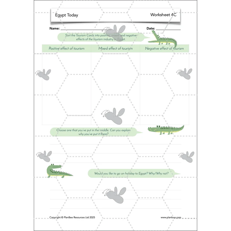
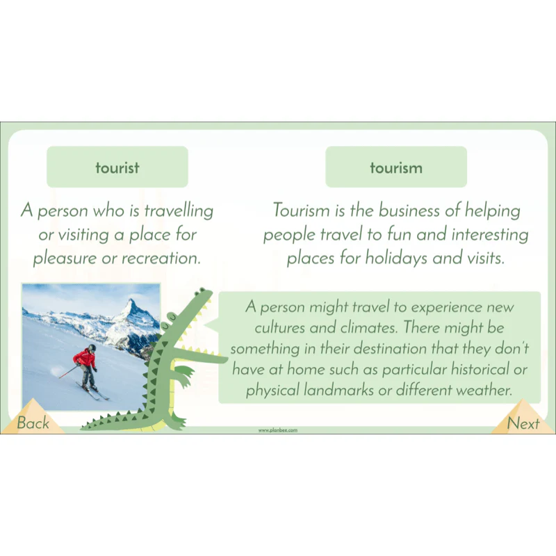
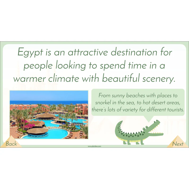
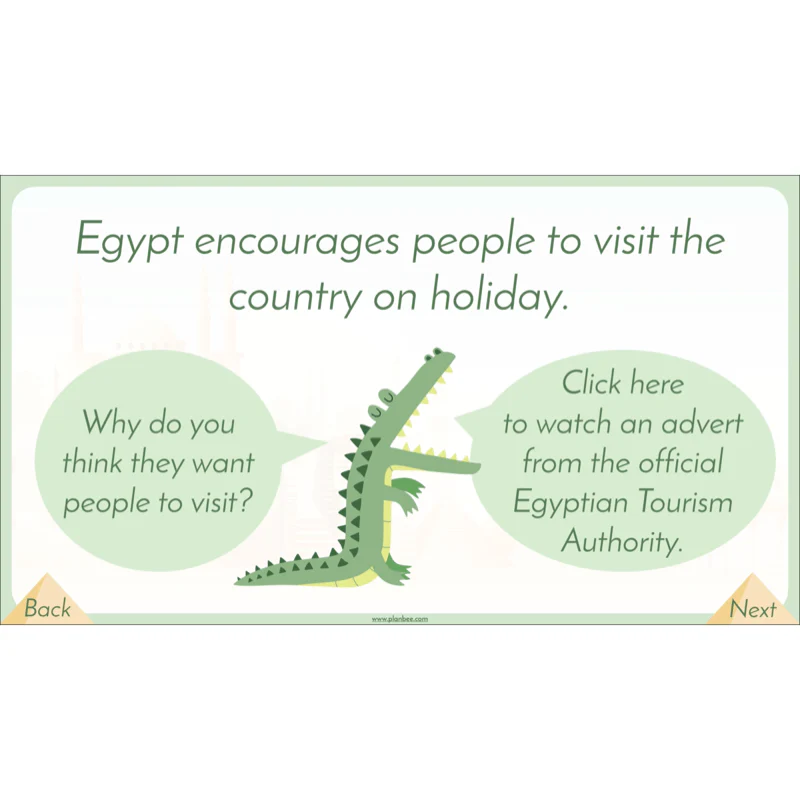
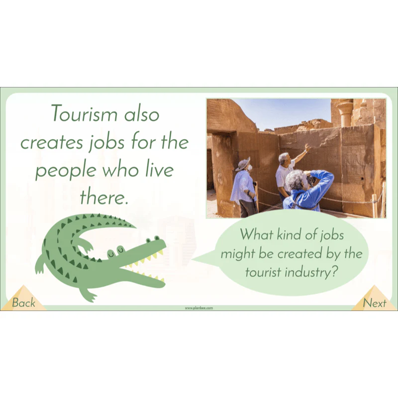
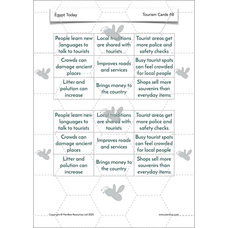
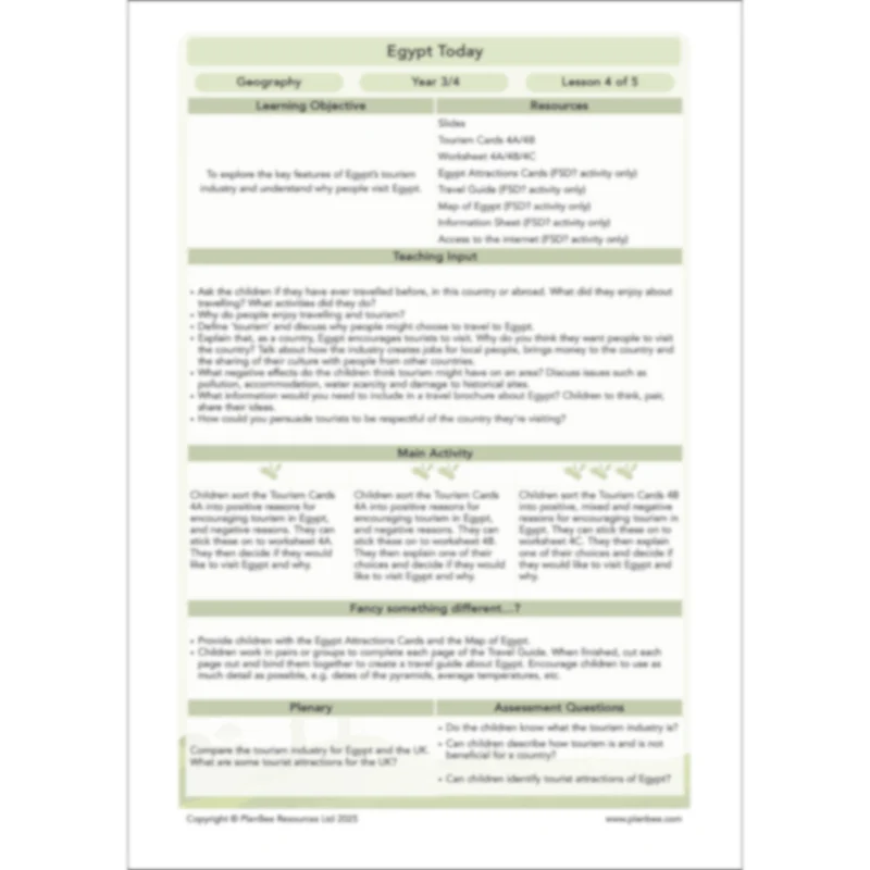
Tourism in Egypt
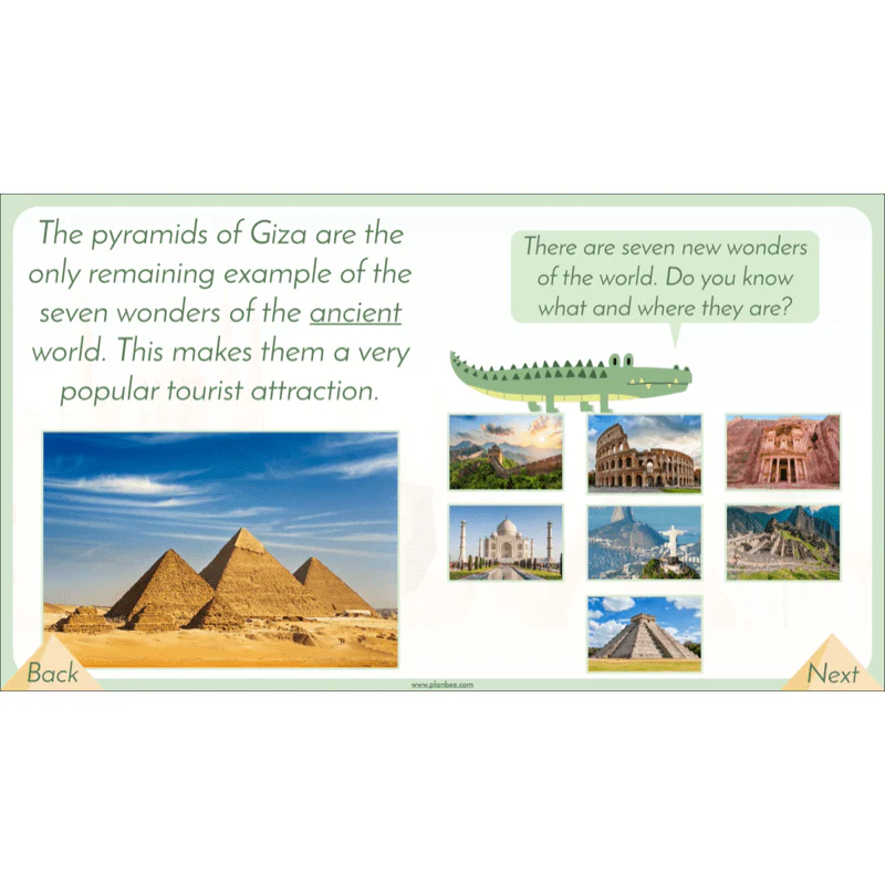
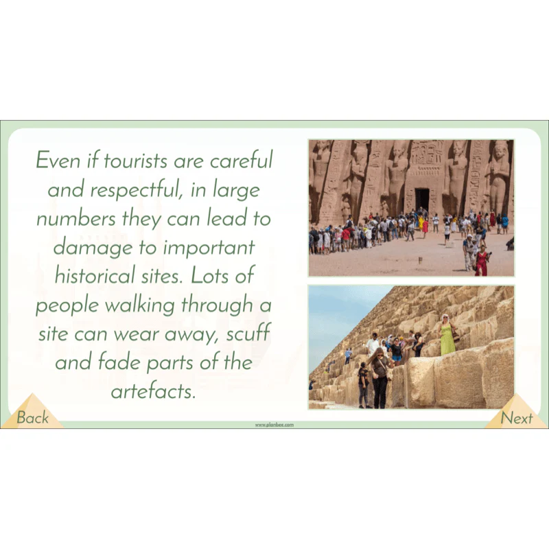
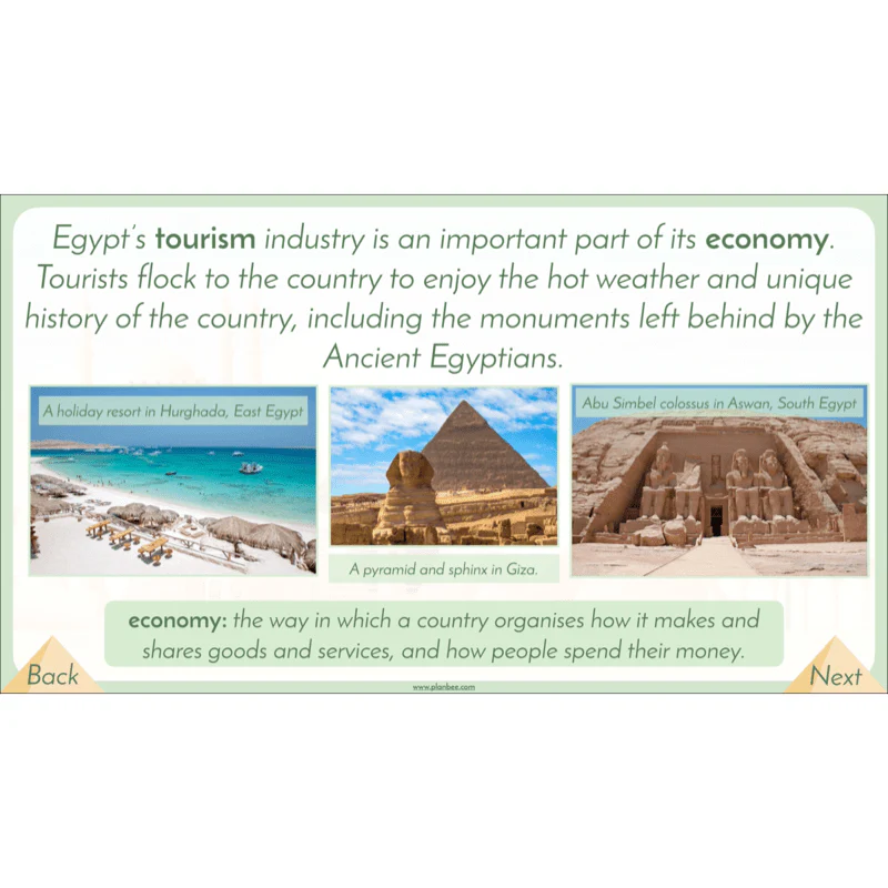
One of the biggest contributors to Egypt's economy is the tourism industry. Your class will investigate what tourism is and how it can affect a country and the 'hot spots' that tourists might choose to visit.
The children will discuss the pros and cons to encouraging tourism in Egypt before applying this to their independent work on the differentiated worksheets. The alternate 'Fancy Something Different?' activity challenges groups of children to use all they have learnt about Egypt to create a travel guide.
What's included:
- Lesson plan
- Slides
- Activity ideas
- Tourism Cards
- Differentiated worksheets
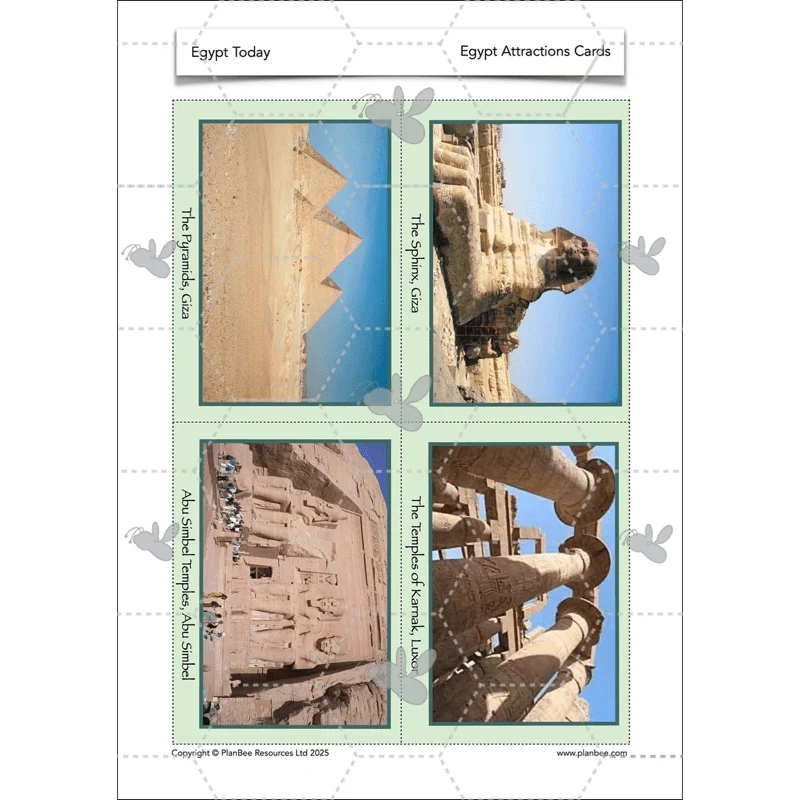
- Egypt Attractions cards
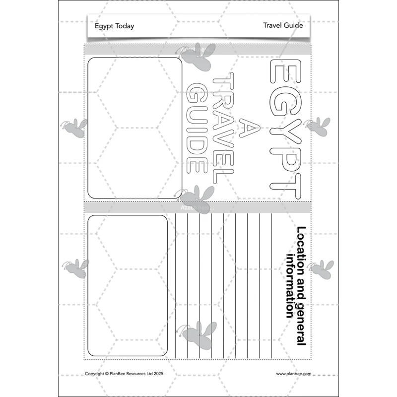
- Travel guide
- Map of Egypt
- Information sheet
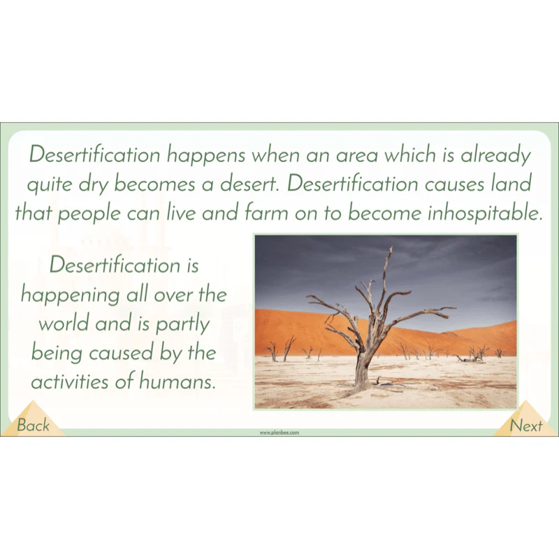
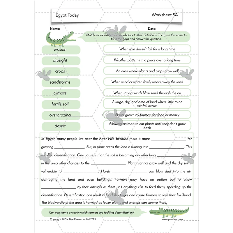
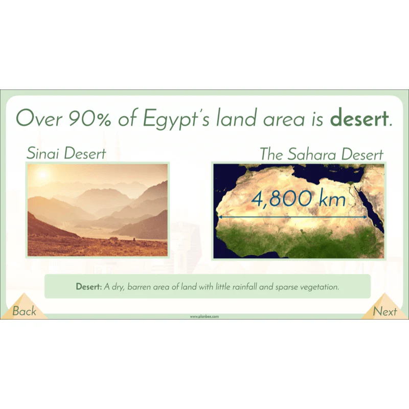
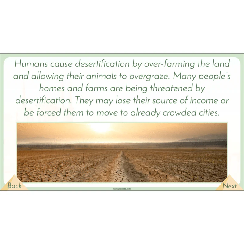
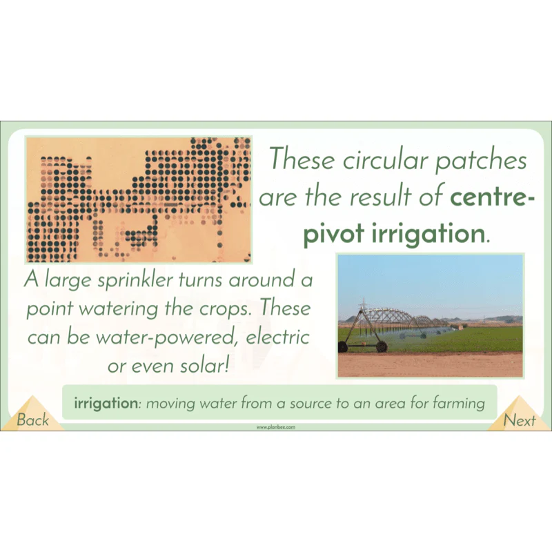
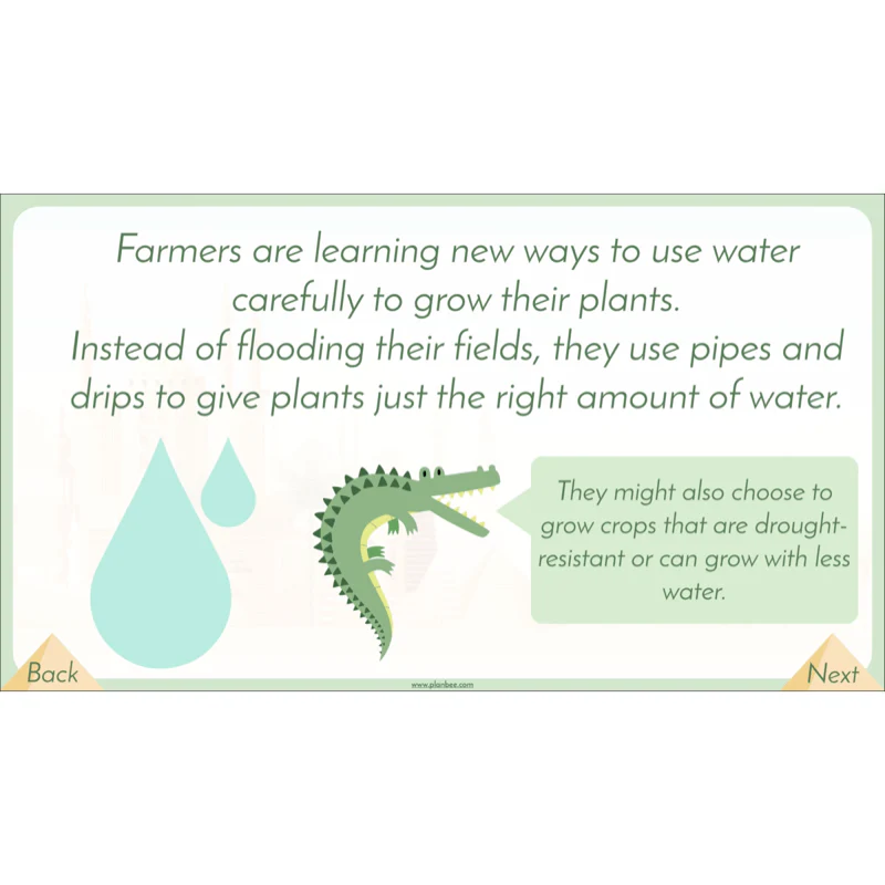
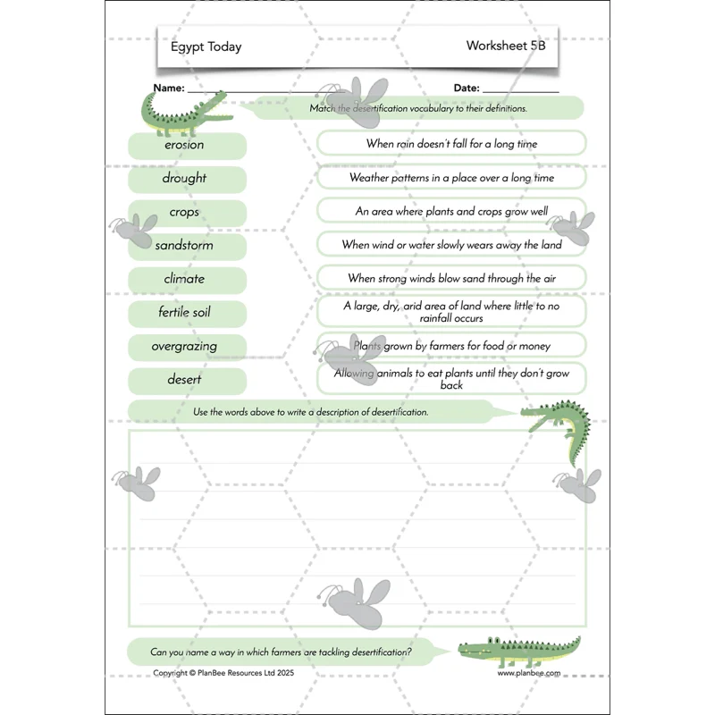
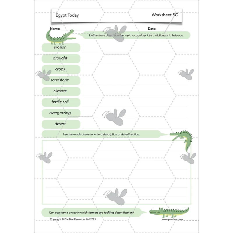
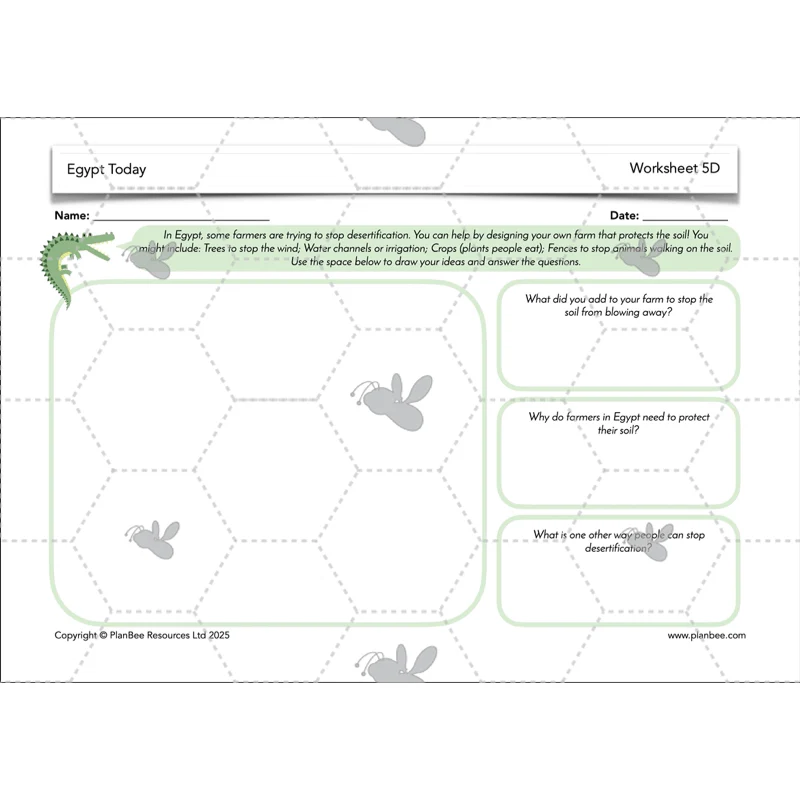
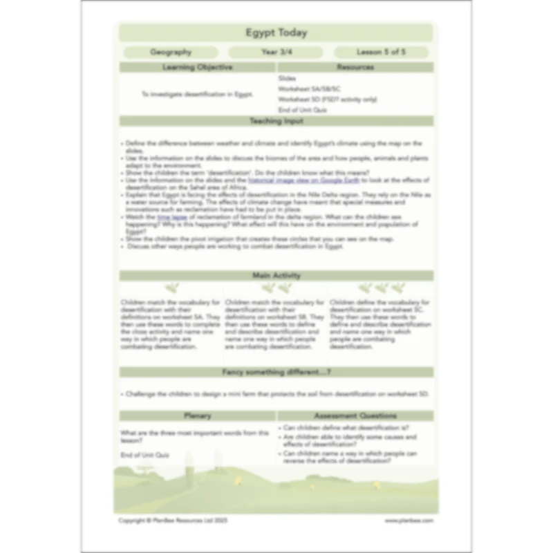
Desertification
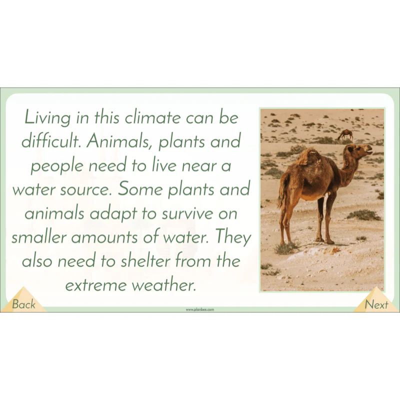
This lesson aims to teach your KS2 class about the phenomenon of desertification along with the causes and effects that this has on a country and the people who live there.
This lesson focuses on how Egypt aims to reverse the effects of desertification and reclaim land back from the desert to create more farmland to feed the growing population. Finish the unit with a fun quiz to assess your class's learning.
This lesson comes with all you need to teach your class about desertification, including a lesson plan, differentiated activities and a PDF lesson input slideshow.
What's included:
- Lesson plan
- Slides
- Activity ideas
- Differentiated worksheets
- End of unit quiz
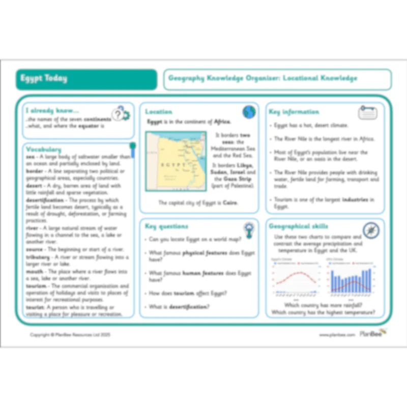
This Year 3/4 Geography Knowledge Organiser has been created to complement our Geography Locational Knowledge strand. It is designed to support your children’s understanding of key vocabulary linked to this scheme of work. Key questions and relevant geographical skills have been identified to encourage children to apply their knowledge around this topic.
Original: $1.99
-50%$1.99
$1.00More Images


Egypt Today
Investigate the home of the famous River Nile in this five-lesson Geography scheme for Year 3 and Year 4. The lessons guide your class through exploring the fascinating landscape and climate of Egypt, including how the River Nile was, and still is, a lifeline for the people who live in Egypt.
In these lessons your class will discuss the human and physical features of Egypt, how tourism affects a country and why they would encourage tourists to visit as well as the causes and effects of desertification on an area. With everything you need to teach about the geography of Egypt, this scheme is a fantastic complement to a topic on Ancient Egypt.
You may also like our Ancient Egyptians Topic Bundle which has four fully-prepared schemes of work all themed around ancient Egypt!
Where is Egypt?
Can you locate Egypt on a map? This lesson focuses on the location of Egypt and encourages your class to use digital and physical maps to gain an understanding of where this country is in the world.
Children will then use existing maps to help them create their own map of the country, including physical features such as the River Nile and sea borders. Alternatively, the children will practise retrieval as they play Teach Me/Tell Me using facts learnt during the lesson.
This lesson comes complete with a detailed lesson plan, lesson slides and all the printable resources you'll need to support your class as they work independently.
What's included:
- Lesson plan
- Slides
- Activity ideas
- Differentiated worksheets
- Teach Me/Tell Me cards
- Teach Me/Tell Me cards teacher notes
- Blank fact cards
Features of Egypt
After an overview of Egypt and some of its features in the previous lesson, the children will be challenged to gain a deeper understanding of the human and physical features of Egypt through map study and data charts. They are encouraged to ask and answer questions when presented with geographical data about Egypt.
The children will be presented with different facts that they have to interpret and use to answer questions about Egypt in their independent work.
This lesson comes with all the printable resources you'll need as well as a detailed lesson plan, PDF lesson slides and differentiated activity ideas.
What's included:
- Lesson plan
- Slides
- Activity ideas
- Differentiated worksheets
- Information sheet
- Fact hunt sheets
- Chart sheet
The River Nile
Teach your class about the longest river in Africa as they investigate the geographical features of the River Nile, such as length, tributaries, source and mouth, as well as looking at which countries besides Egypt the Nile runs through.
Children will use the provided map to identify the route of the River Nile through Africa. Alternatively the children will investigate how the River Nile is used today and compare this to how it might have been used in Ancient Egypt.
What's included:
- Lesson plan
- Slides
- Activity ideas
- Differentiated worksheets
- River Nile map sheet
- Fact cards
- River Nile use cards
Tourism in Egypt
One of the biggest contributors to Egypt's economy is the tourism industry. Your class will investigate what tourism is and how it can affect a country and the 'hot spots' that tourists might choose to visit.
The children will discuss the pros and cons to encouraging tourism in Egypt before applying this to their independent work on the differentiated worksheets. The alternate 'Fancy Something Different?' activity challenges groups of children to use all they have learnt about Egypt to create a travel guide.
What's included:
- Lesson plan
- Slides
- Activity ideas
- Tourism Cards
- Differentiated worksheets
- Egypt Attractions cards
- Travel guide
- Map of Egypt
- Information sheet
Desertification
This lesson aims to teach your KS2 class about the phenomenon of desertification along with the causes and effects that this has on a country and the people who live there.
This lesson focuses on how Egypt aims to reverse the effects of desertification and reclaim land back from the desert to create more farmland to feed the growing population. Finish the unit with a fun quiz to assess your class's learning.
This lesson comes with all you need to teach your class about desertification, including a lesson plan, differentiated activities and a PDF lesson input slideshow.
What's included:
- Lesson plan
- Slides
- Activity ideas
- Differentiated worksheets
- End of unit quiz
This Year 3/4 Geography Knowledge Organiser has been created to complement our Geography Locational Knowledge strand. It is designed to support your children’s understanding of key vocabulary linked to this scheme of work. Key questions and relevant geographical skills have been identified to encourage children to apply their knowledge around this topic.
Product Information
Product Information
Shipping & Returns
Shipping & Returns
Description
Investigate the home of the famous River Nile in this five-lesson Geography scheme for Year 3 and Year 4. The lessons guide your class through exploring the fascinating landscape and climate of Egypt, including how the River Nile was, and still is, a lifeline for the people who live in Egypt.
In these lessons your class will discuss the human and physical features of Egypt, how tourism affects a country and why they would encourage tourists to visit as well as the causes and effects of desertification on an area. With everything you need to teach about the geography of Egypt, this scheme is a fantastic complement to a topic on Ancient Egypt.
You may also like our Ancient Egyptians Topic Bundle which has four fully-prepared schemes of work all themed around ancient Egypt!
Where is Egypt?
Can you locate Egypt on a map? This lesson focuses on the location of Egypt and encourages your class to use digital and physical maps to gain an understanding of where this country is in the world.
Children will then use existing maps to help them create their own map of the country, including physical features such as the River Nile and sea borders. Alternatively, the children will practise retrieval as they play Teach Me/Tell Me using facts learnt during the lesson.
This lesson comes complete with a detailed lesson plan, lesson slides and all the printable resources you'll need to support your class as they work independently.
What's included:
- Lesson plan
- Slides
- Activity ideas
- Differentiated worksheets
- Teach Me/Tell Me cards
- Teach Me/Tell Me cards teacher notes
- Blank fact cards
Features of Egypt
After an overview of Egypt and some of its features in the previous lesson, the children will be challenged to gain a deeper understanding of the human and physical features of Egypt through map study and data charts. They are encouraged to ask and answer questions when presented with geographical data about Egypt.
The children will be presented with different facts that they have to interpret and use to answer questions about Egypt in their independent work.
This lesson comes with all the printable resources you'll need as well as a detailed lesson plan, PDF lesson slides and differentiated activity ideas.
What's included:
- Lesson plan
- Slides
- Activity ideas
- Differentiated worksheets
- Information sheet
- Fact hunt sheets
- Chart sheet
The River Nile
Teach your class about the longest river in Africa as they investigate the geographical features of the River Nile, such as length, tributaries, source and mouth, as well as looking at which countries besides Egypt the Nile runs through.
Children will use the provided map to identify the route of the River Nile through Africa. Alternatively the children will investigate how the River Nile is used today and compare this to how it might have been used in Ancient Egypt.
What's included:
- Lesson plan
- Slides
- Activity ideas
- Differentiated worksheets
- River Nile map sheet
- Fact cards
- River Nile use cards
Tourism in Egypt
One of the biggest contributors to Egypt's economy is the tourism industry. Your class will investigate what tourism is and how it can affect a country and the 'hot spots' that tourists might choose to visit.
The children will discuss the pros and cons to encouraging tourism in Egypt before applying this to their independent work on the differentiated worksheets. The alternate 'Fancy Something Different?' activity challenges groups of children to use all they have learnt about Egypt to create a travel guide.
What's included:
- Lesson plan
- Slides
- Activity ideas
- Tourism Cards
- Differentiated worksheets
- Egypt Attractions cards
- Travel guide
- Map of Egypt
- Information sheet
Desertification
This lesson aims to teach your KS2 class about the phenomenon of desertification along with the causes and effects that this has on a country and the people who live there.
This lesson focuses on how Egypt aims to reverse the effects of desertification and reclaim land back from the desert to create more farmland to feed the growing population. Finish the unit with a fun quiz to assess your class's learning.
This lesson comes with all you need to teach your class about desertification, including a lesson plan, differentiated activities and a PDF lesson input slideshow.
What's included:
- Lesson plan
- Slides
- Activity ideas
- Differentiated worksheets
- End of unit quiz
This Year 3/4 Geography Knowledge Organiser has been created to complement our Geography Locational Knowledge strand. It is designed to support your children’s understanding of key vocabulary linked to this scheme of work. Key questions and relevant geographical skills have been identified to encourage children to apply their knowledge around this topic.