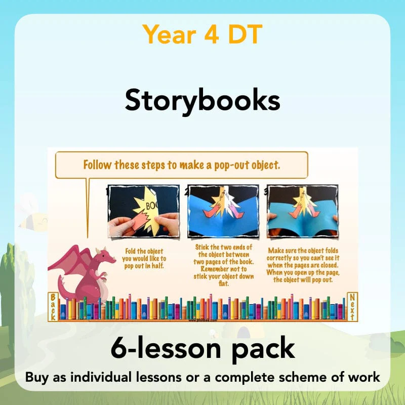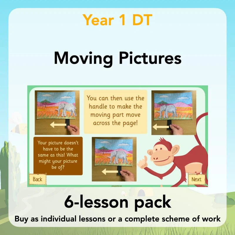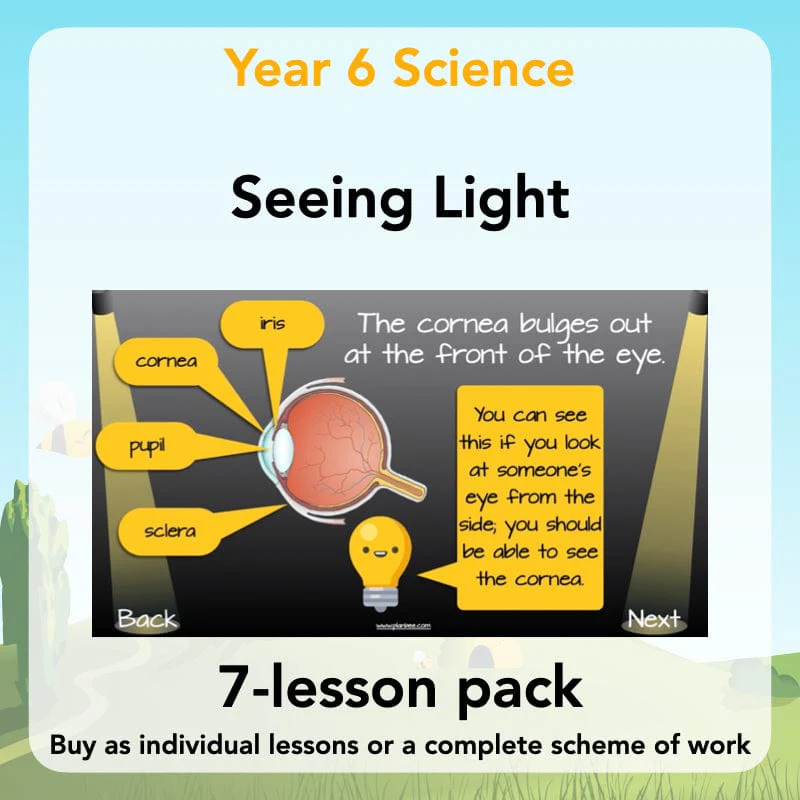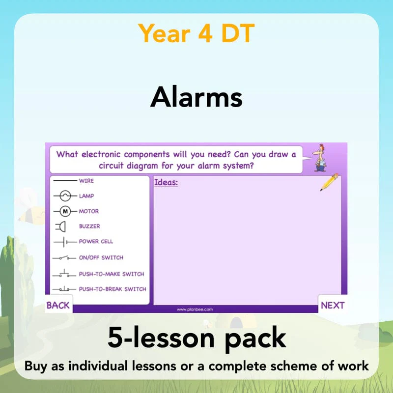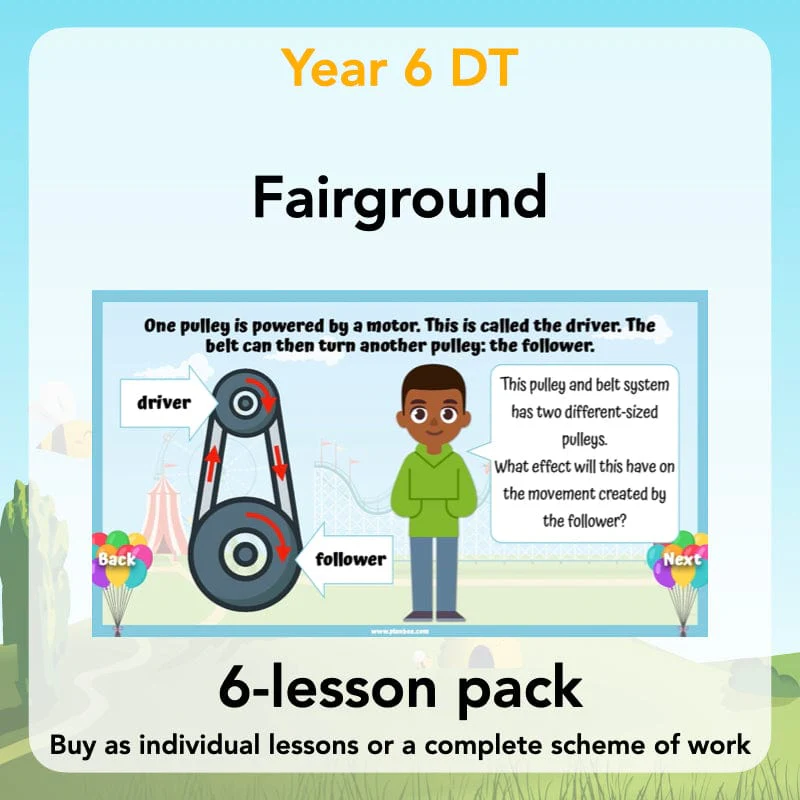
Investigating Rivers
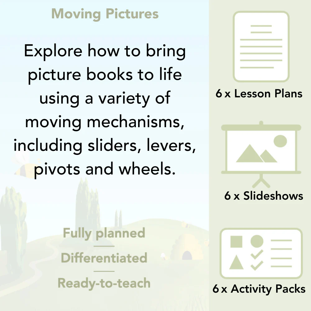
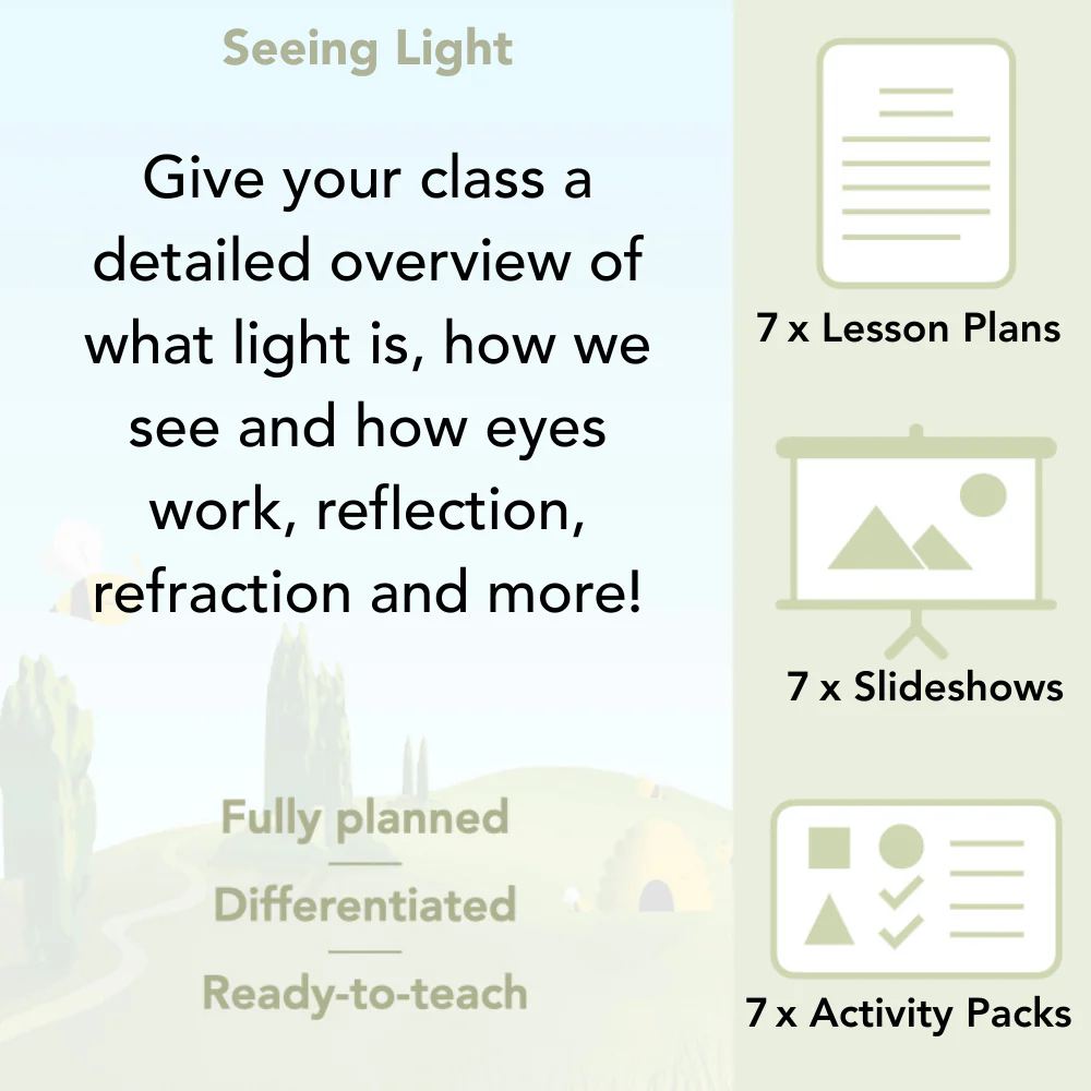
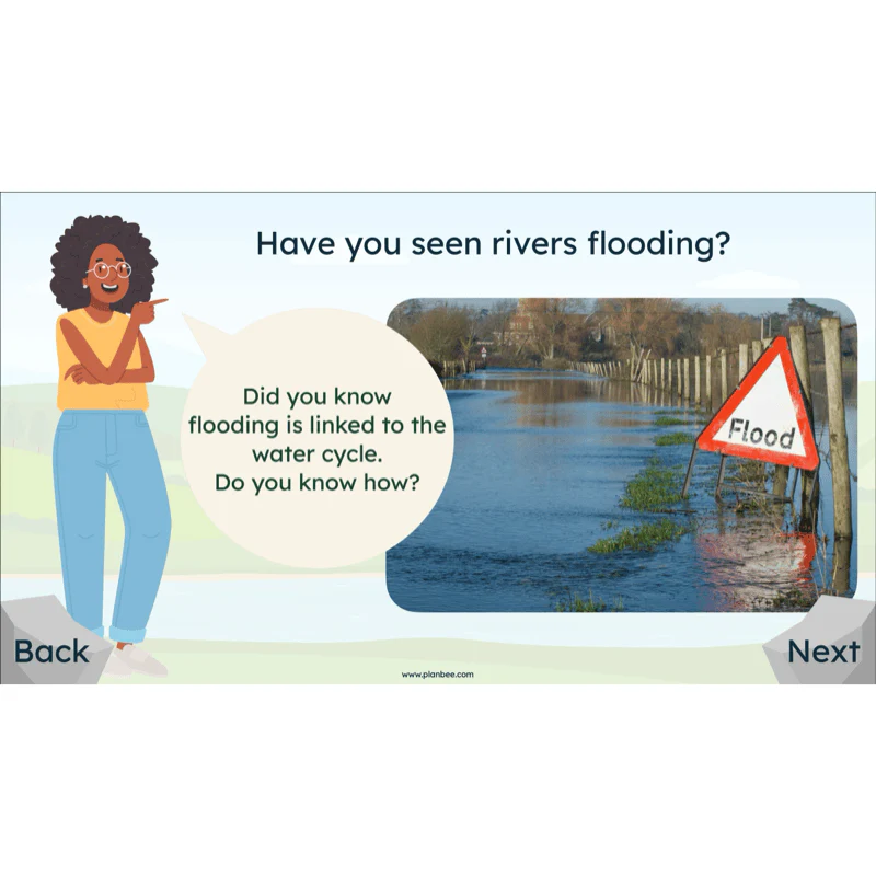
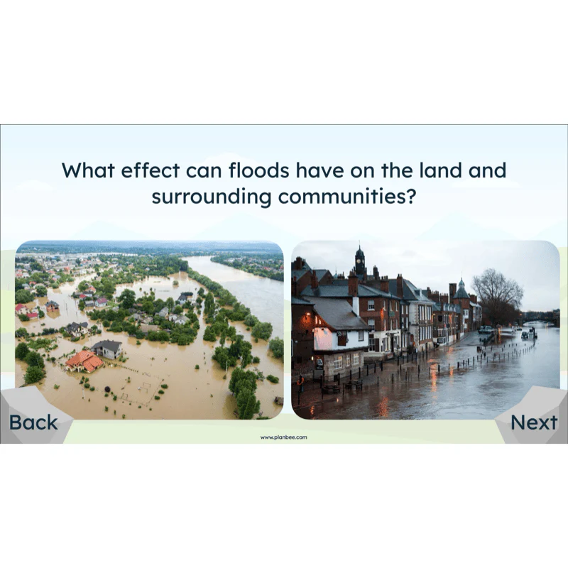
Make a splash with our Investigating Rivers scheme for Year 5/6! Packed with ready-to-teach lesson plans, engaging slides and printable resources, this unit takes children on a river’s journey from source to mouth, exploring how erosion, transportation and deposition shape the landscape. Pupils connect rivers to the water cycle, compare UK and world rivers, and consider how people use and manage these vital waterways. Clear, age-appropriate explanations, rich vocabulary and case-study prompts (including an accessible town-river scenario) help children see how rivers affect wildlife, settlements and everyday life, including what happens when rivers flood.
Hands-on geography is at the heart of this unit. Children plan and carry out a local river enquiry: observing safely, sketching and photographing features, timing flow speed, and measuring simple variables like width, then turning their notes into evidence-based conclusions. Mapwork and digital mapping/Google Earth tasks build locational knowledge, while differentiated worksheets, a pupil-friendly end-of-unit quiz, and a one-page Knowledge Organiser support recall for all learners. Everything is designed with UK curriculum aims in mind (Environmental, Human and Physical processes), with built-in guidance, safety notes and optional challenges so you can pick up and teach with confidence.
A Knowledge Organiser is available to support the learning in this scheme. It is included in the Complete Series download or can be purchased individually.
Lesson 1: Key Features of Rivers
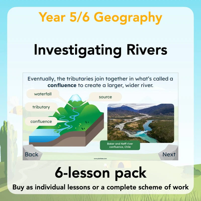
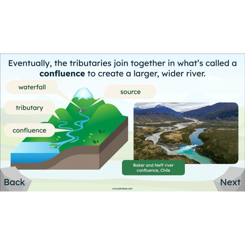
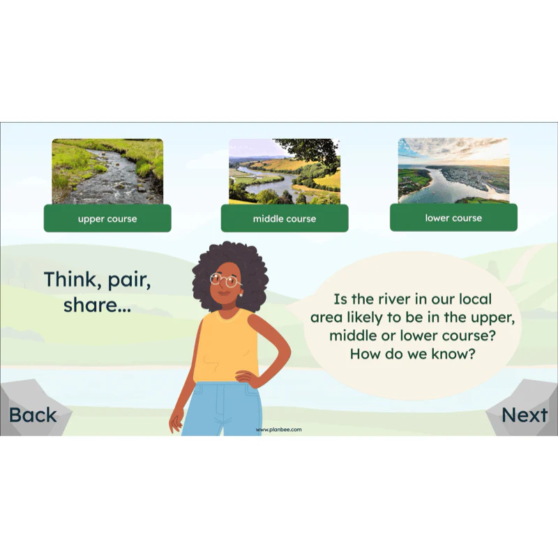
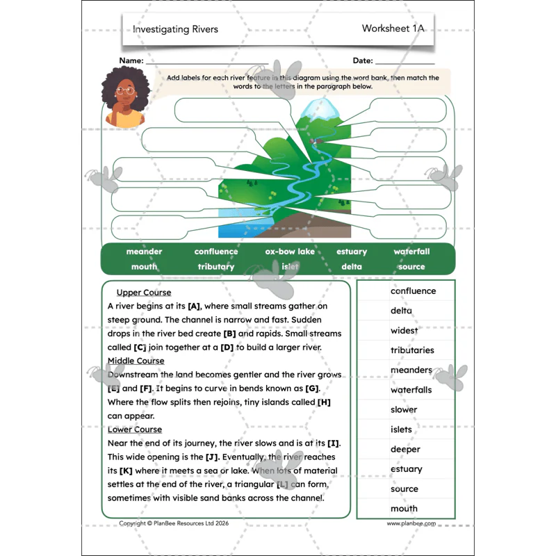
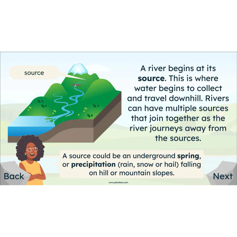
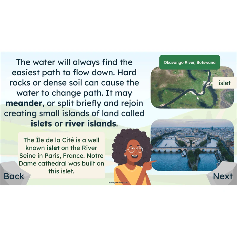
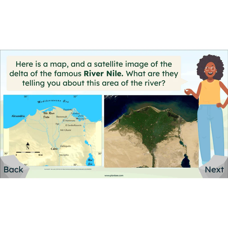
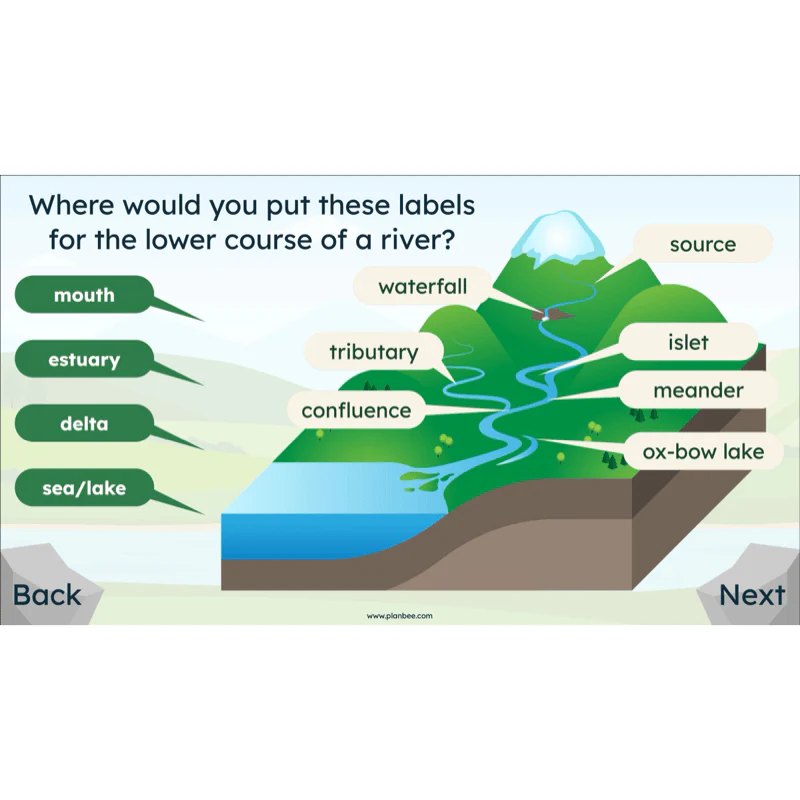
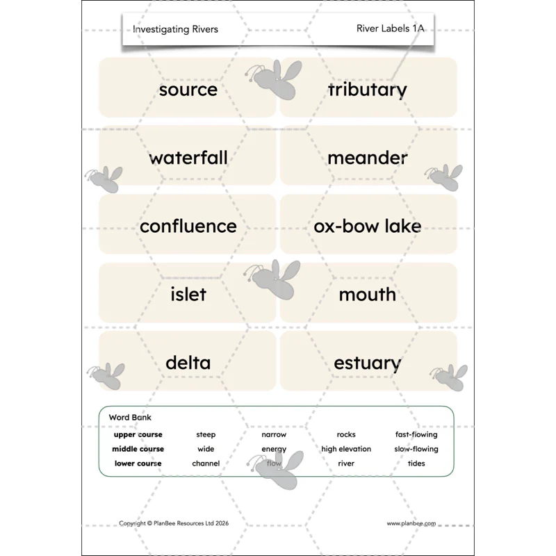
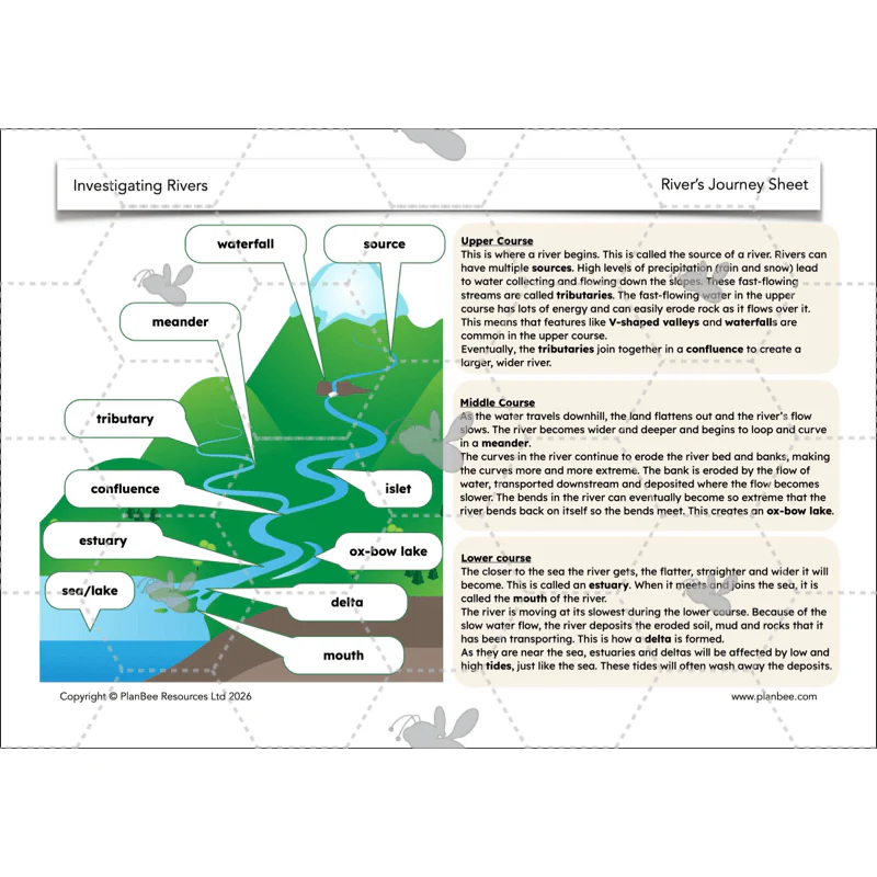
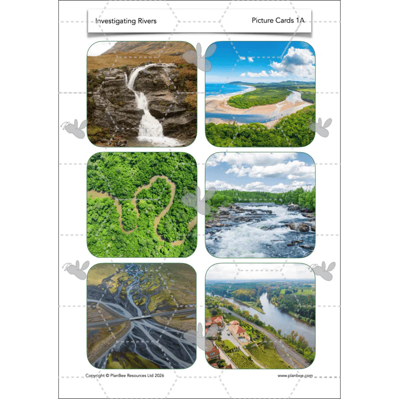
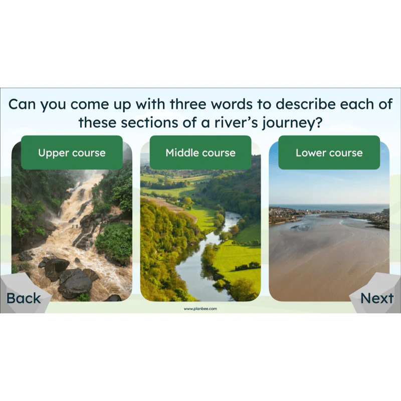
Introduce rivers as geographical features of a landscape and explore the different features of a river that one might find. Help your children look at the river's journey from its source in the upper course, down to the mouth in the lower course.
The children will be challenged to label, draw and describe a river as it flows from source to mouth, making detailed observations from images and diagrams.
What's included:
- Lesson plan
- Slides
- Activity ideas
- Differentiated worksheets
- River labels
- Picture cards
- River's journey sheet
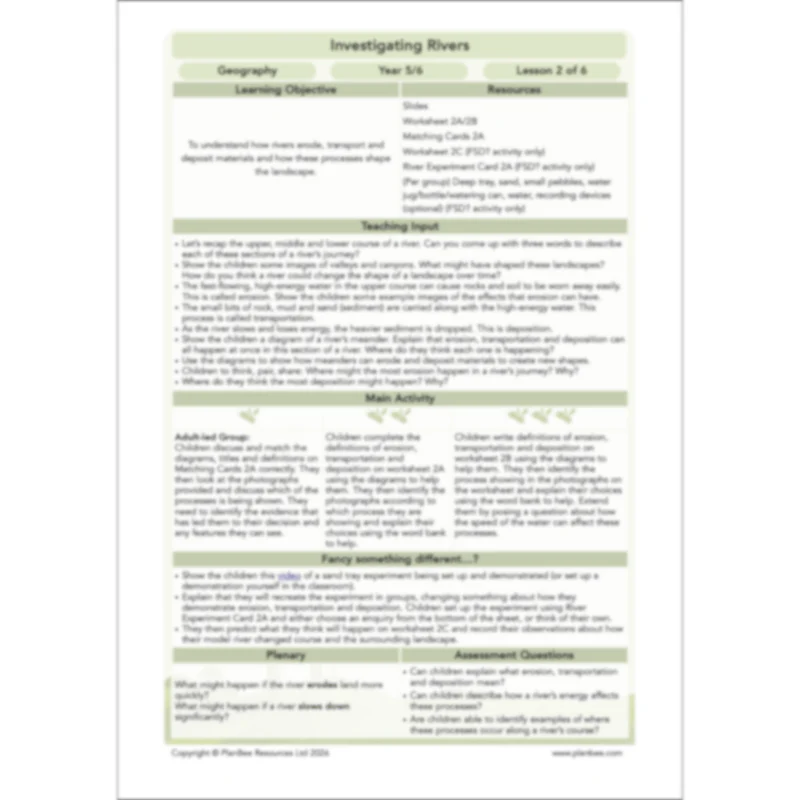
Lesson 2: Erosion, Transportation and Deposition
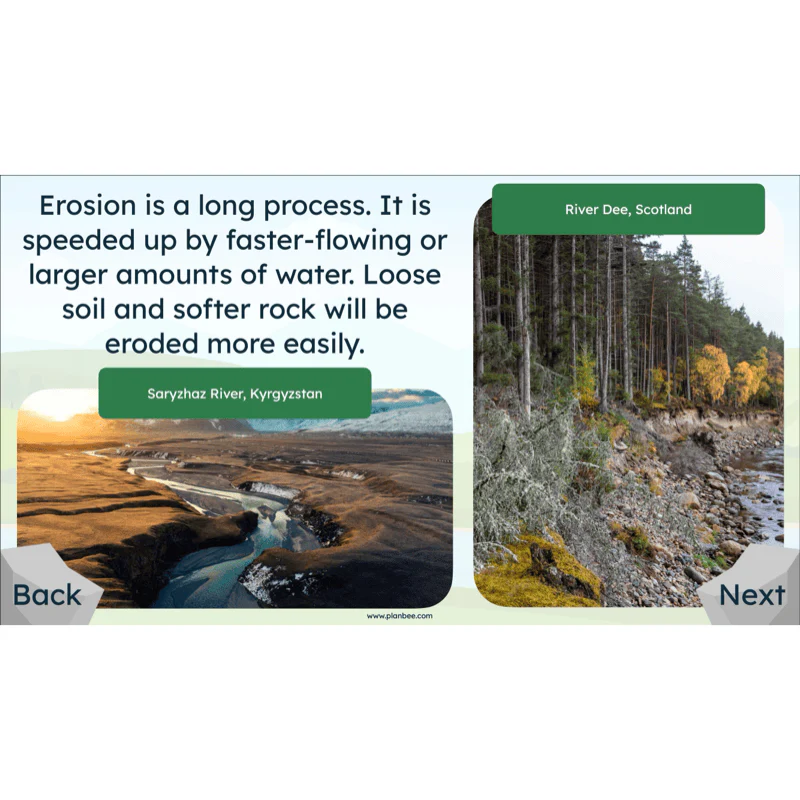
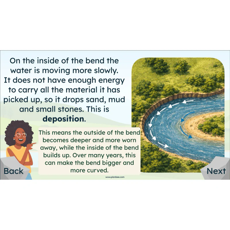
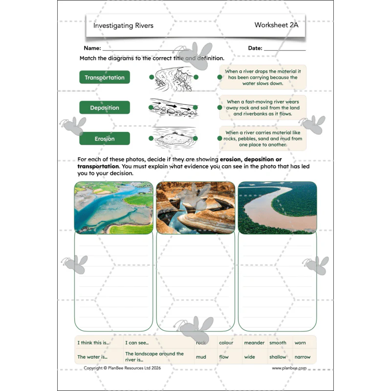
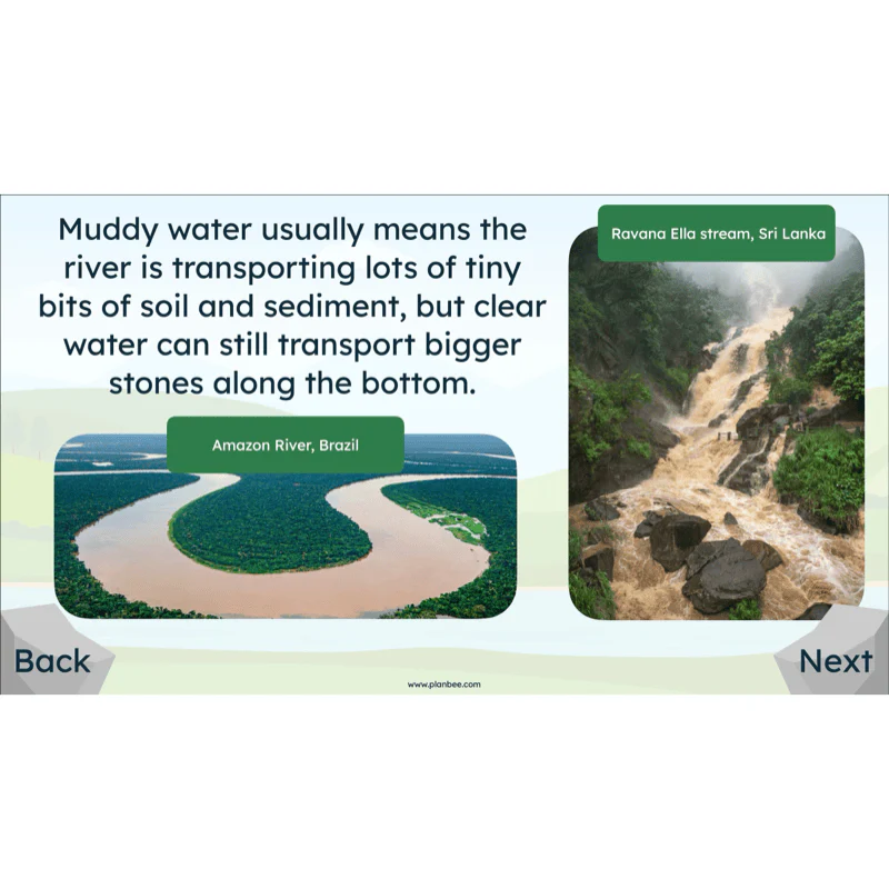
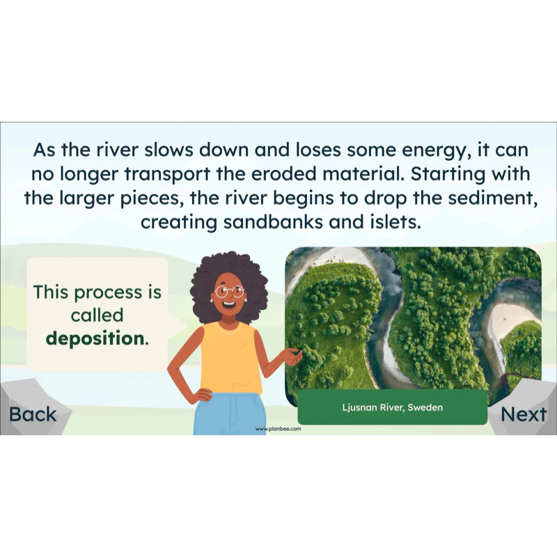
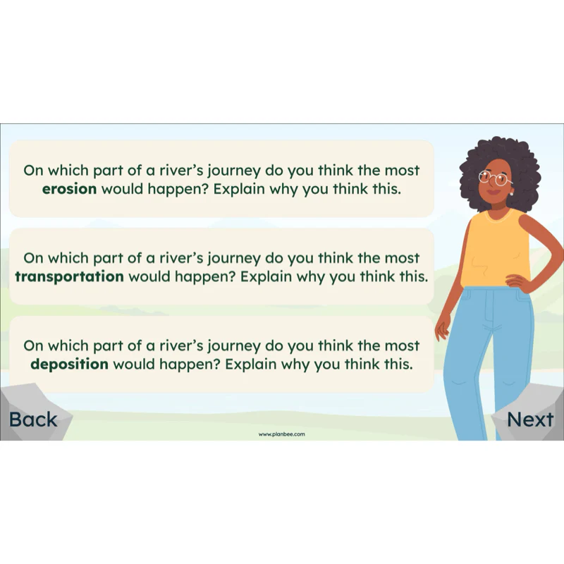
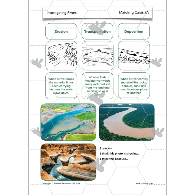
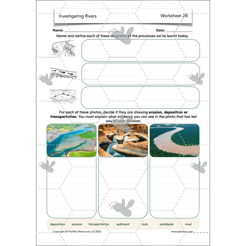
This lesson focuses on the processes which happen as a river runs its course and how they can change the landscape around it. The children are challenged to define the geographical terms erosion, transportation and deposition and identify places that they can see evidence of each.
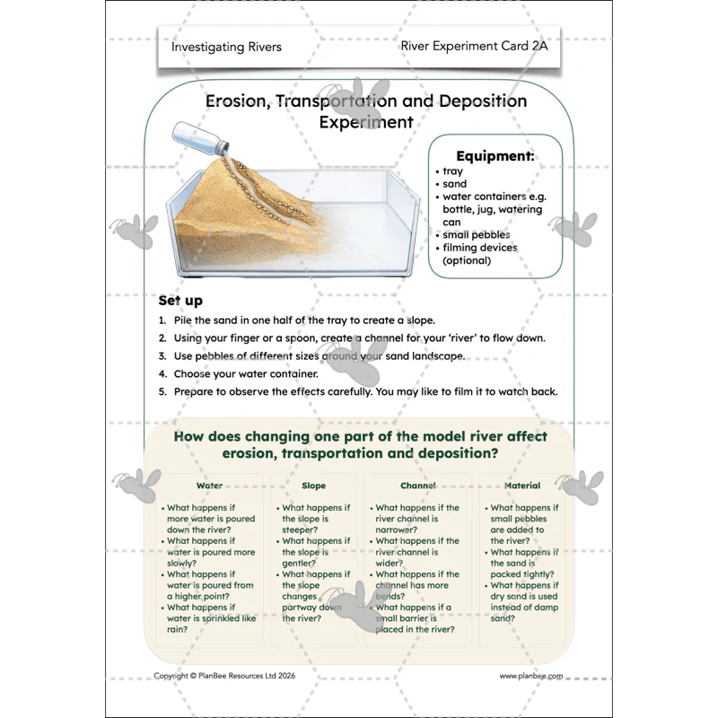
Why not go cross-curricular and have your class make geographical observations during an erosion experiment that aims to depict how the above processes happen as a river flows. They are challenged to change variables and record their observations throughout their experiment.
What's included:
- Lesson plan
- Slides
- Activity ideas
- Differentiated worksheets
- Matching cards
- River experiment card
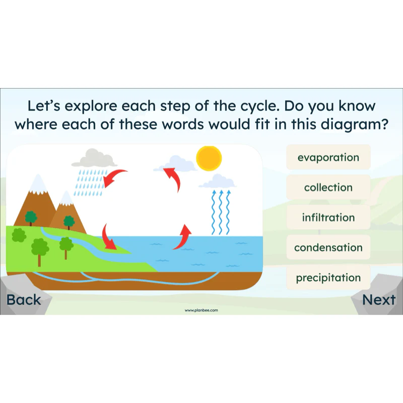
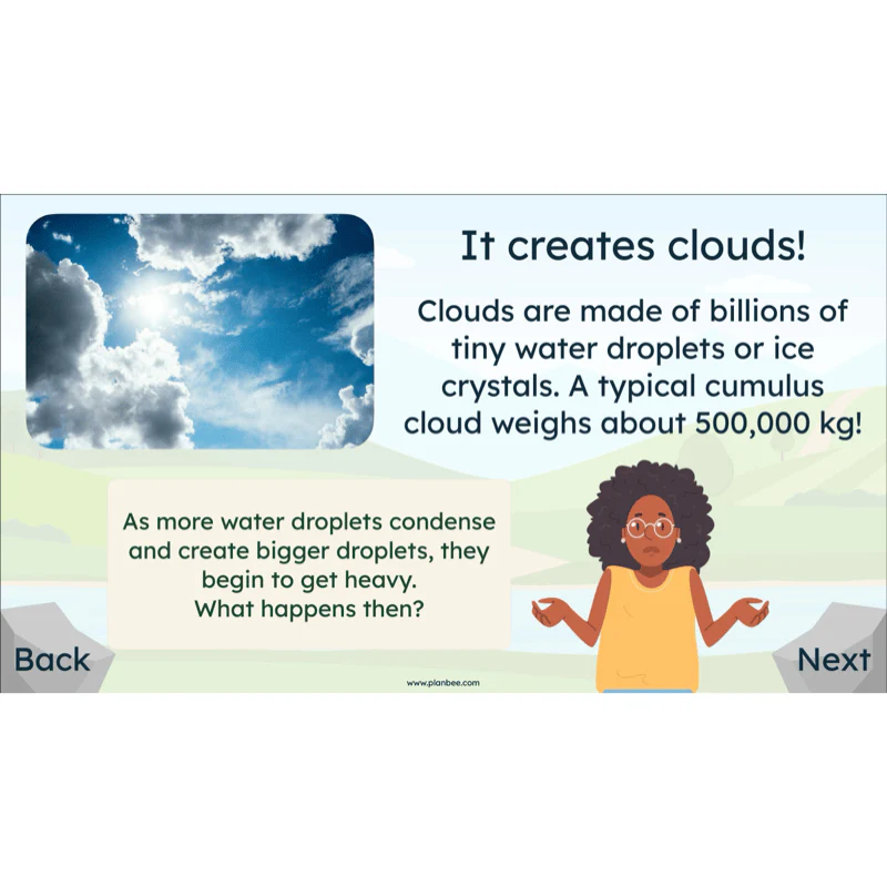
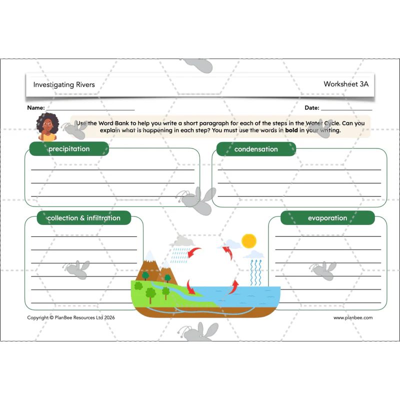
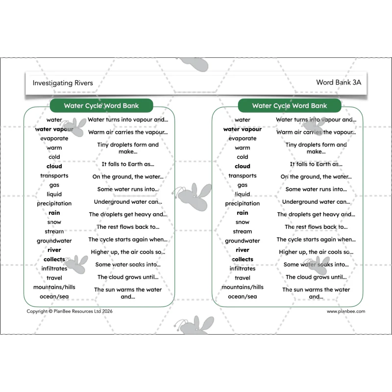
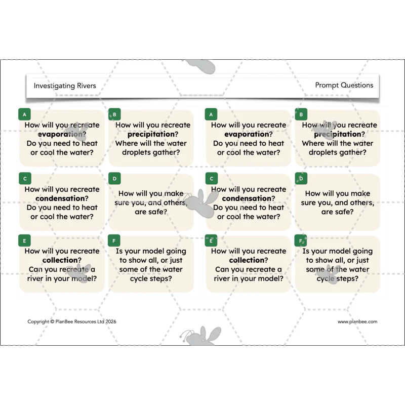
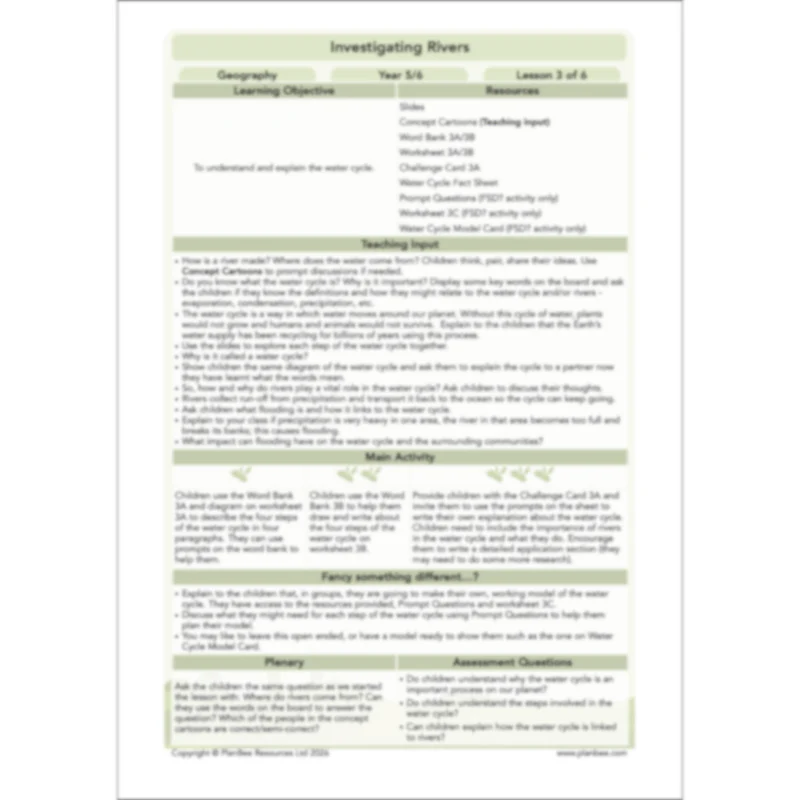
Lesson 3: The Water Cycle
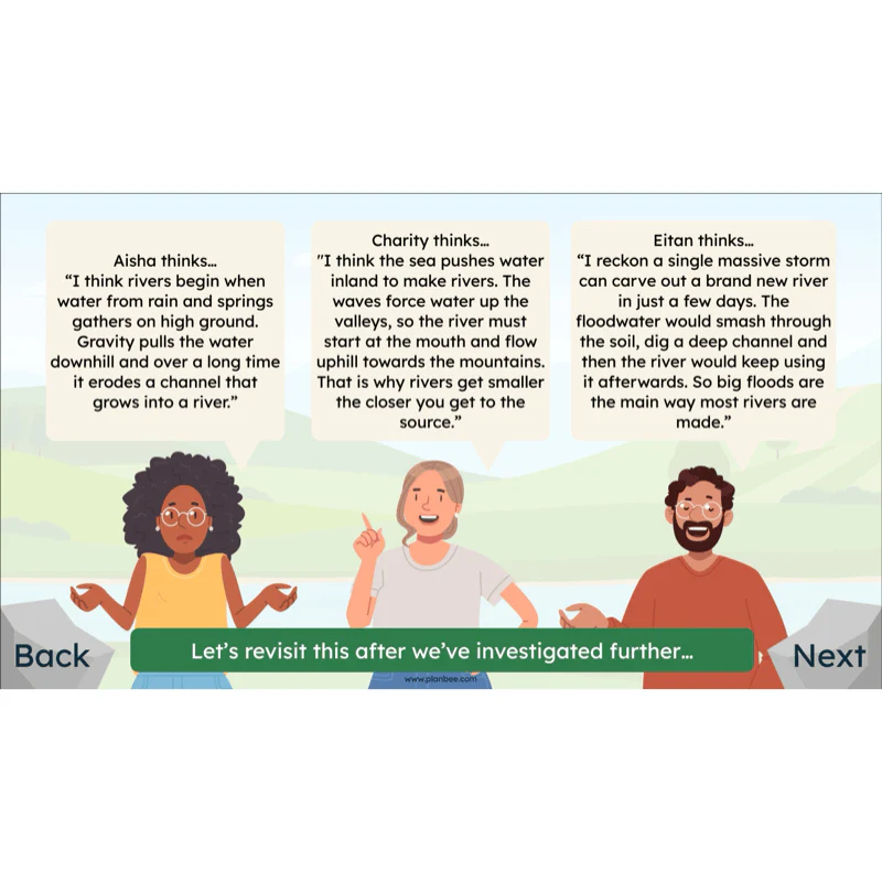
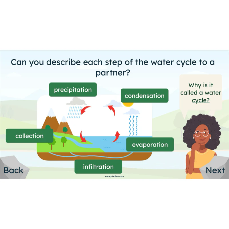
Revise your class's Year 4 Science knowledge as they apply what they know of evaporation and condensation to how rivers are formed. They must use geographical terms such as precipitation to help them describe the important role that rivers play in the water cycle.
Once they have learnt about and discussed the key steps in the water cycle, the children are challenged to apply this to what they have learnt about rivers, their source and journey through a landscape. They will use this to answer the enquiry question "How are Rivers Formed?".
What's included:
- Lesson plan
- Slides
- Activity ideas
- Concept cartoons
- Word banks
- Differentiated worksheets
- Challenge card
- Water cycle fact sheet
- Prompt questions
- Water cycle model card
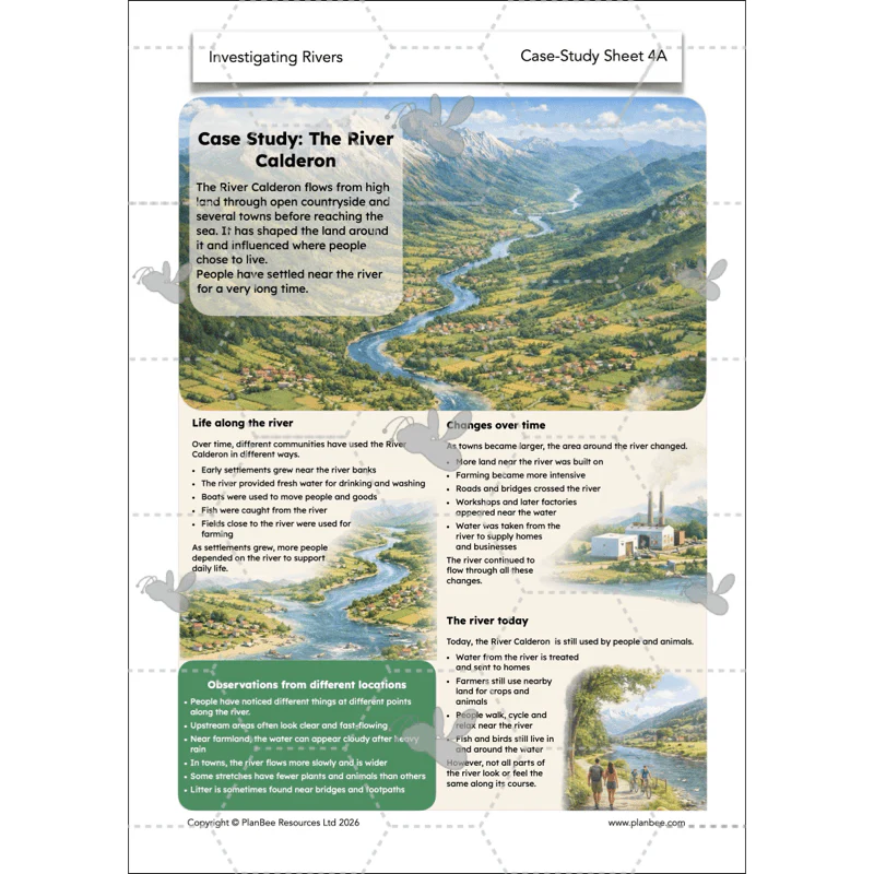
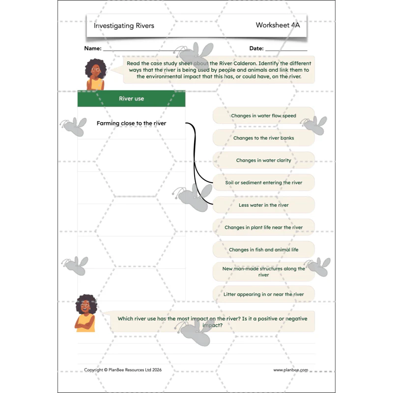
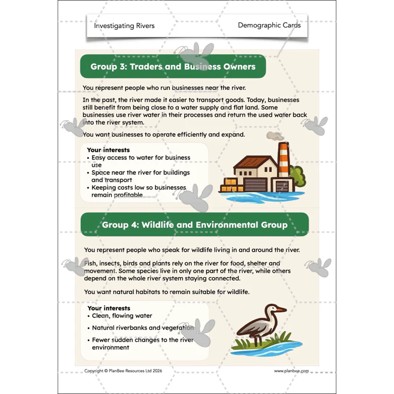
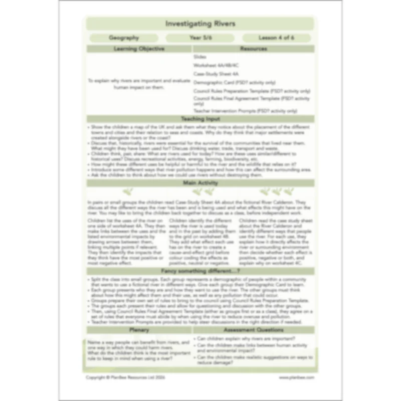
Lesson 4: Why are Rivers Important?
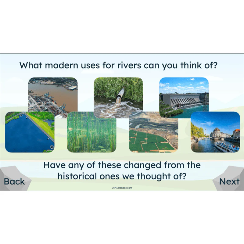
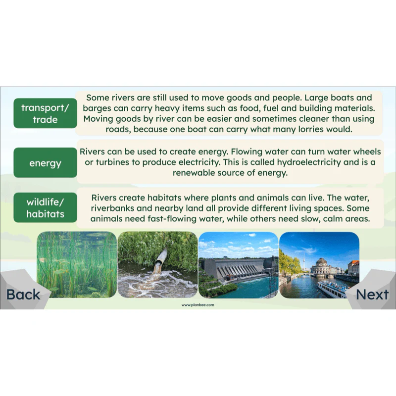
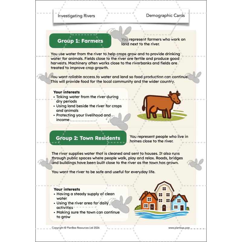
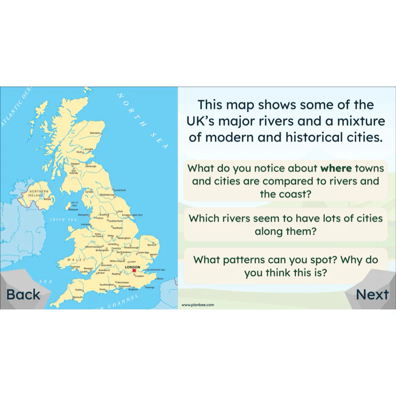
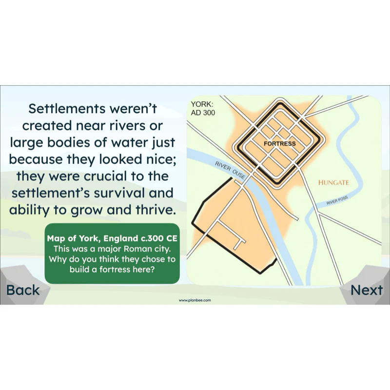
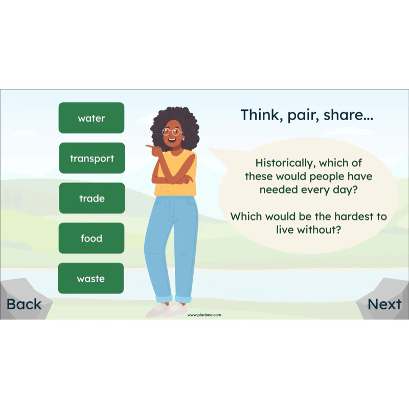
This lesson explores why rivers are important to people and animals and how they have been used both in the past and today. Children identify different river uses, spot patterns between rivers and settlement locations using maps, and compare historical and modern uses to understand how reliance on rivers has changed over time.
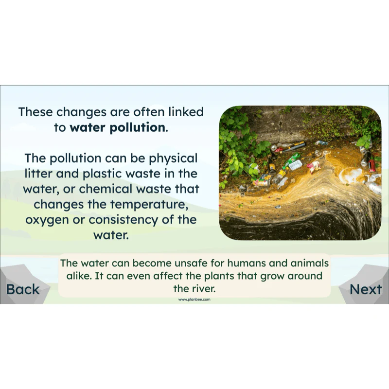
Children then consider how increased use of rivers can lead to changes in water quality, river flow and surrounding environments. They explore how different human activities can impact rivers and evaluate how rules and responsible use can help protect rivers for people, wildlife and future generations.
What's included:
- Lesson plan
- Slides
- Activity ideas
- Differentiated worksheets
- Case-study sheet
- Demographic card
- Council rules preparation template
- Council rules final agreement template
- Teacher intervention prompts
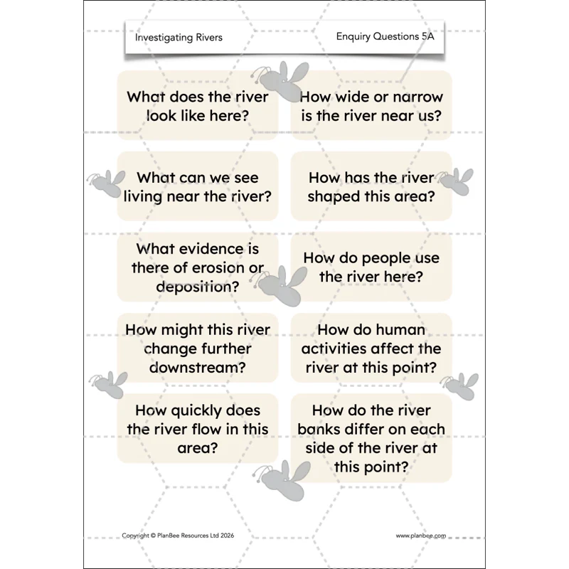
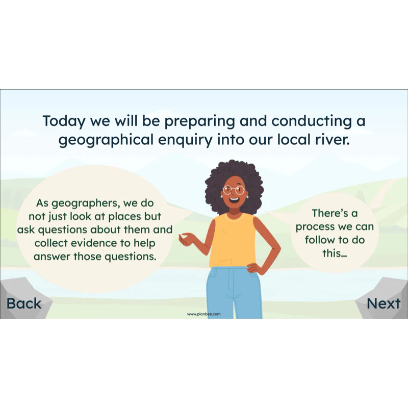
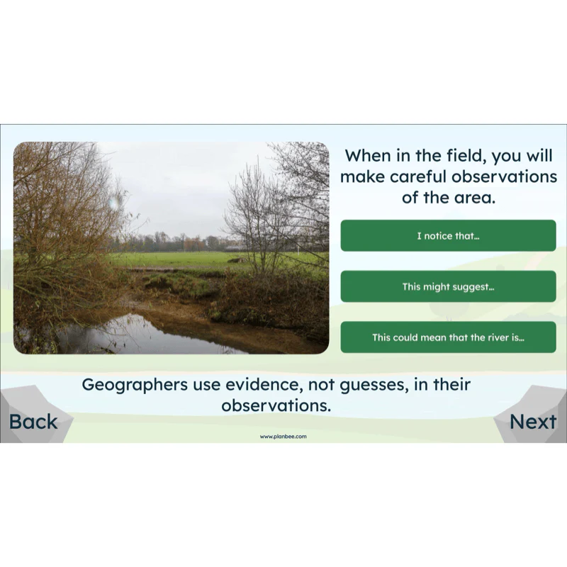
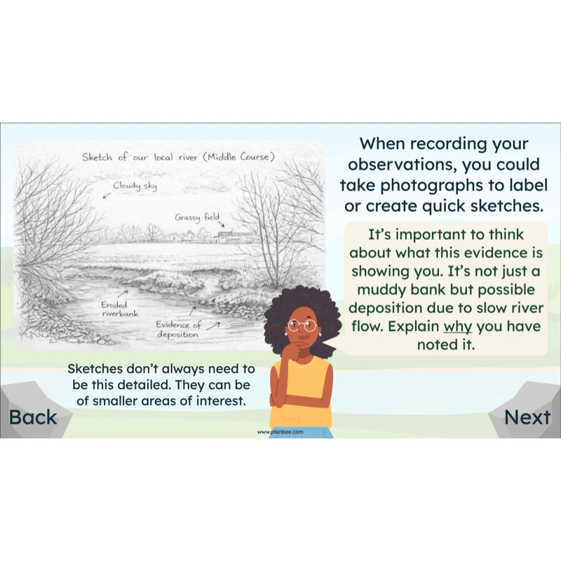
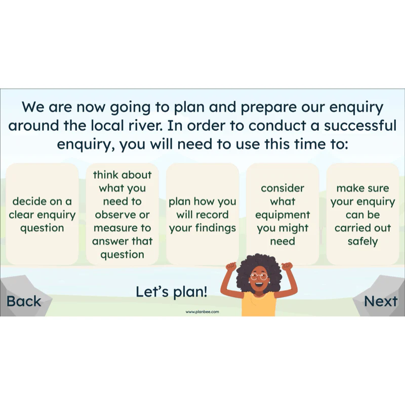
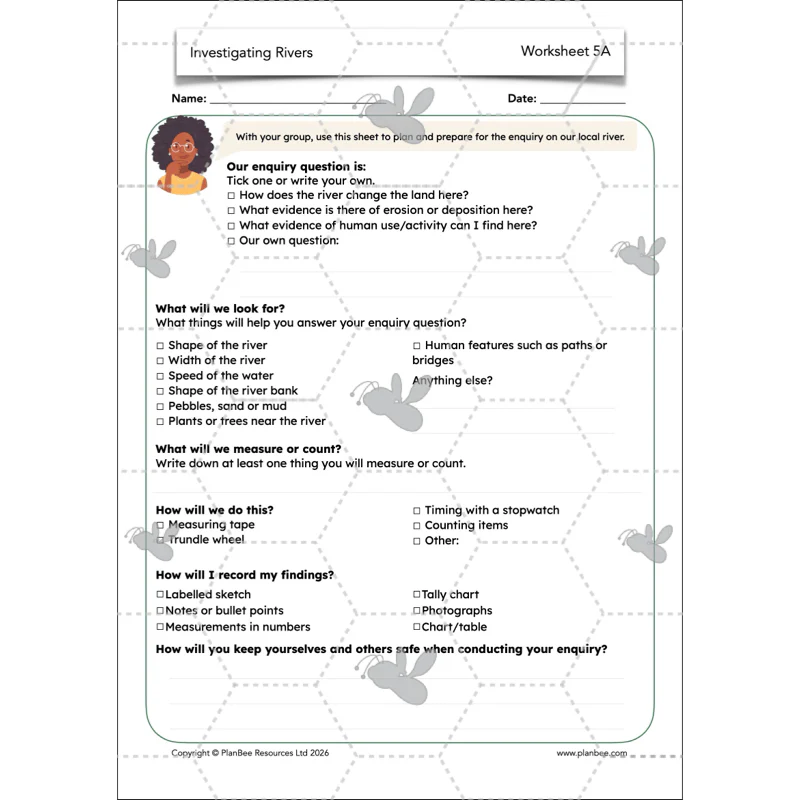
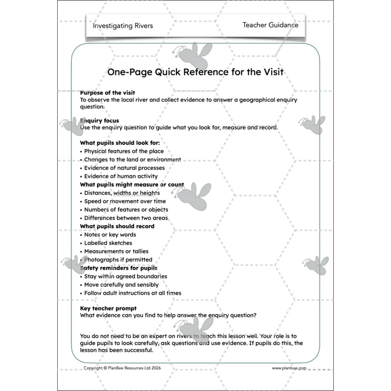
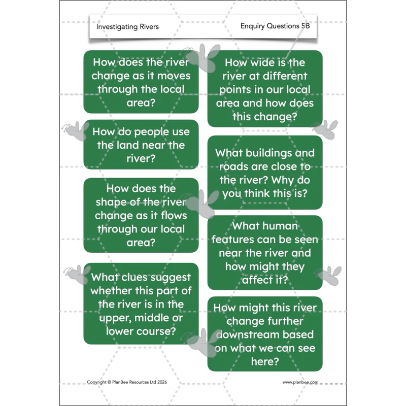
Lesson 5: River Fieldwork
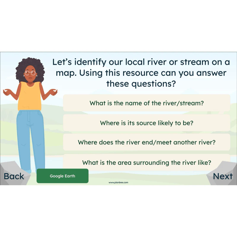
Take your class on a trip to your local river or stream to conduct their own geographical enquiry into the health or uses of the river. The children will use this lesson to plan and prepare for their enquiry in small groups or as a class. Using the supporting resources they will think carefully about what information they can gain from visiting the site of your local river and the different aspects that they may be able to measure.
Alternatively, resources are provided to conduct a river enquiry on your local waterway from the classroom, using maps, digital mapping and photographs to conduct their enquiry.
What's included:
- Lesson plan
- Slides
- Activity ideas
- Worksheet
- Enquiry questions
- Teacher guidance
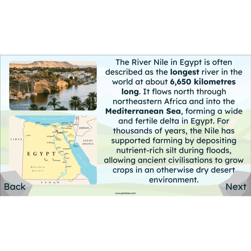
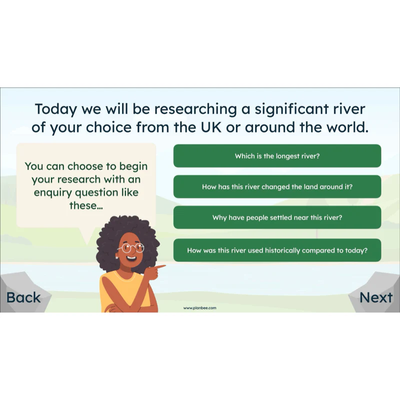
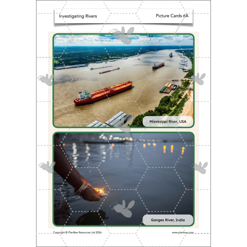
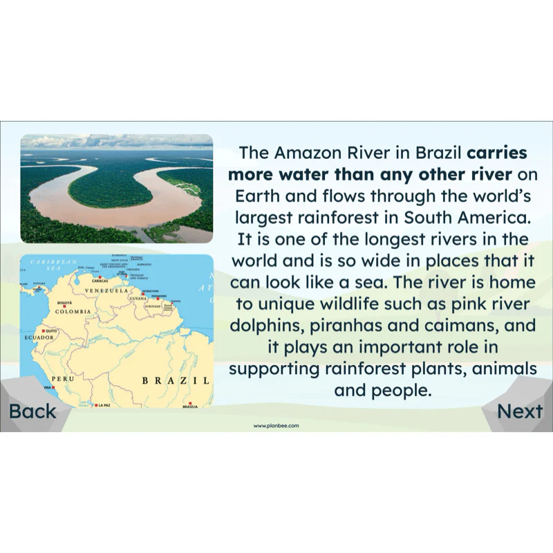
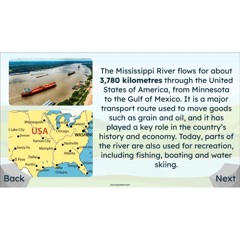
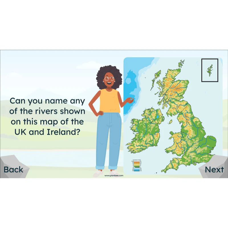
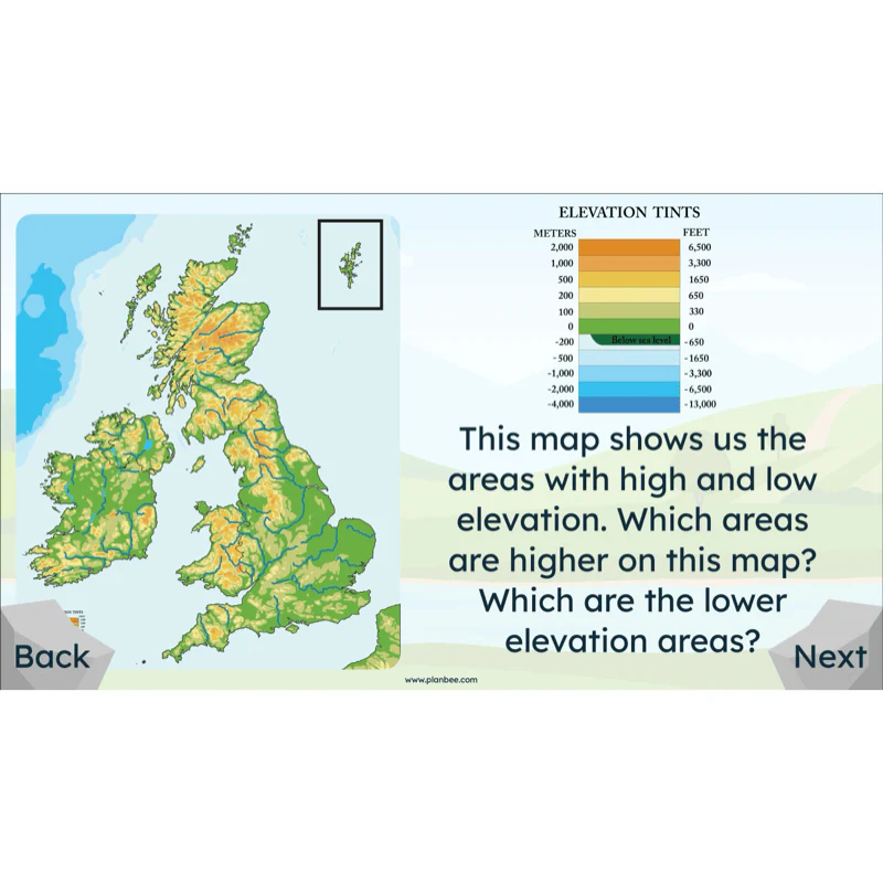
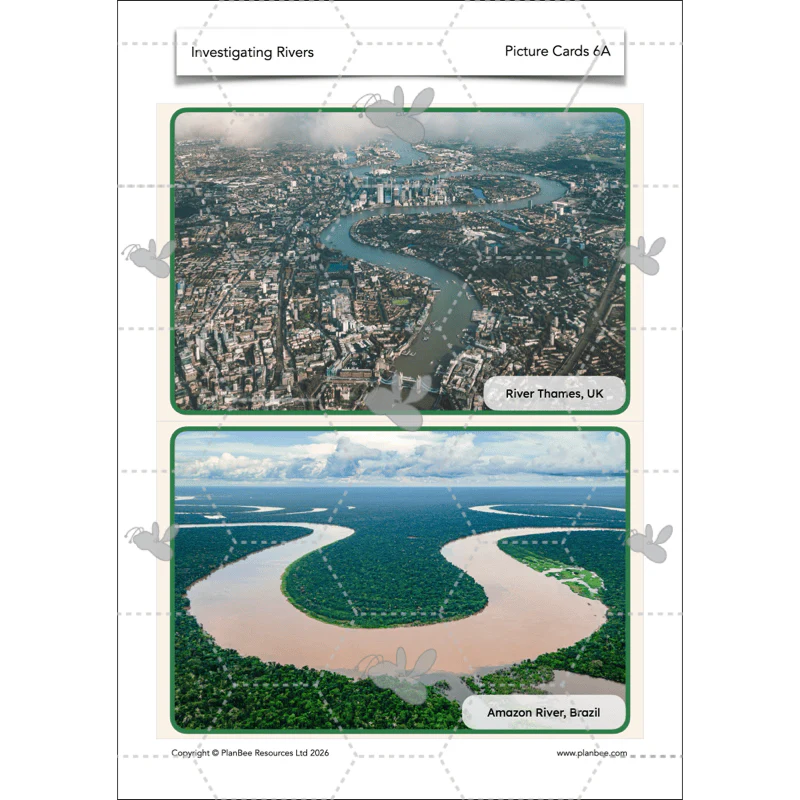
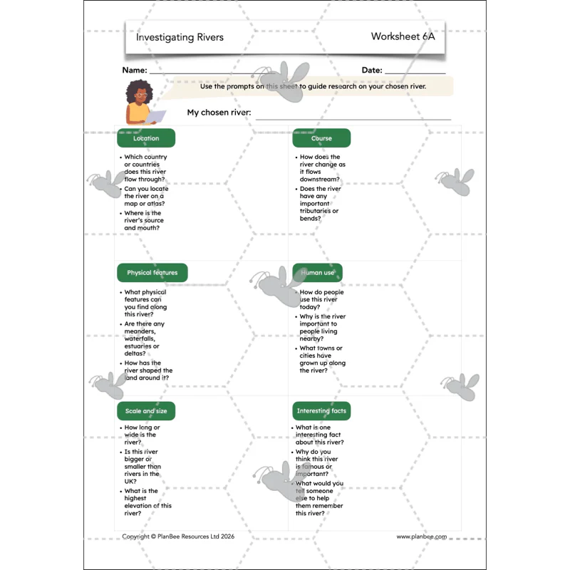
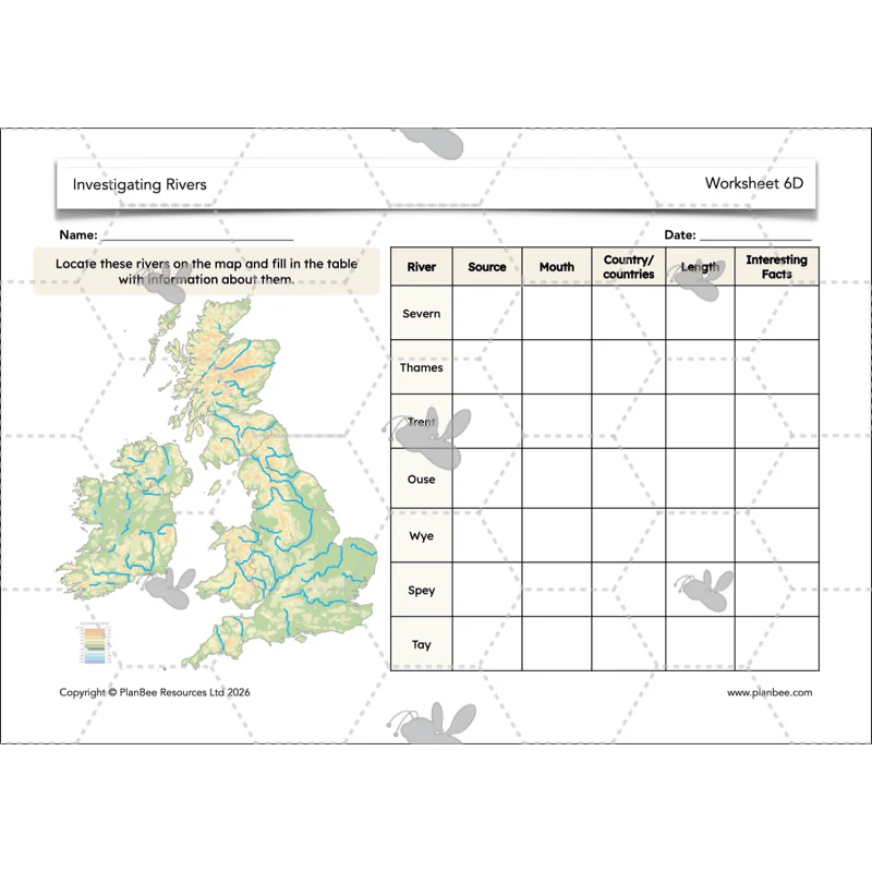
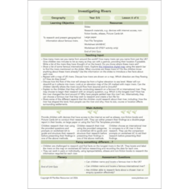
Lesson 6: Researching Famous Rivers
This final lesson challenges children to use their previous learning about rivers, their features and uses to research and create a fact file about their chosen river.
This lesson aims to introduce the children to internationally significant rivers and begin comparing these to those in the UK. The children will use various sources of information to research their river before choosing to answer some enquiry questions about the river(s).
What's included:
- Lesson plan
- Slides
- Activity ideas
- Picture cards
- Fact file template
- Differentiated worksheets
- End of unit quiz
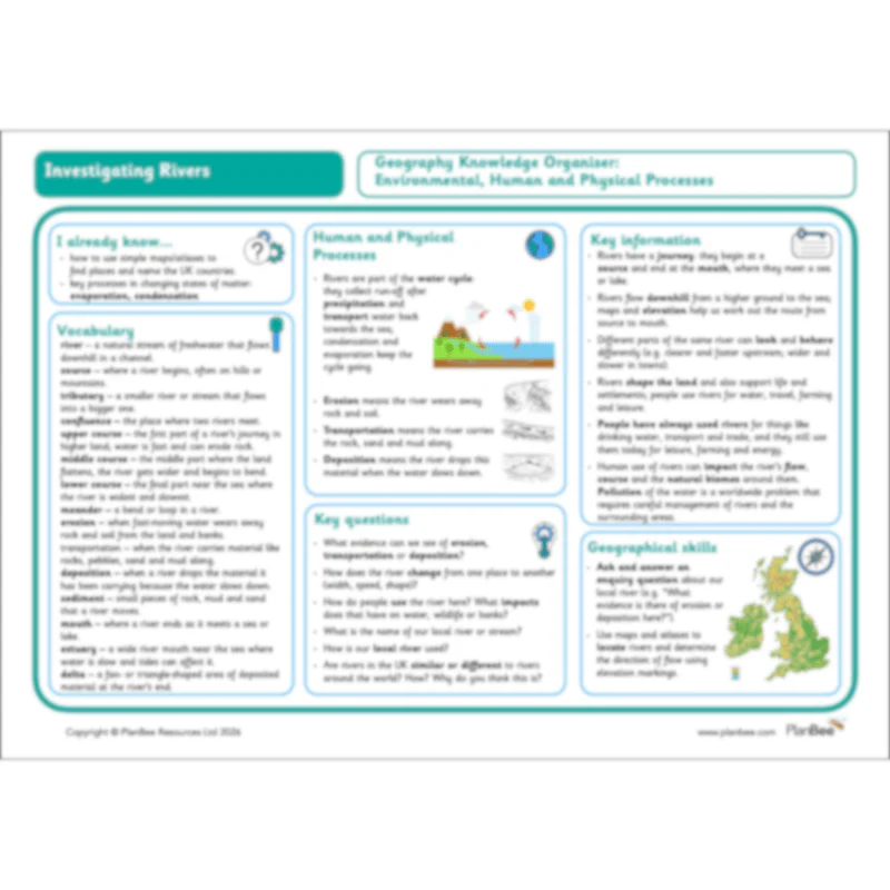
Investigating Rivers: Knowledge Organiser
This Year 5/6 Geography Knowledge Organiser has been created to complement our Environmental, Human and Physical Processes strand. It is designed to support your children’s understanding of key vocabulary linked to this scheme of work. Key questions and relevant geographical skills have been identified to encourage children to apply their knowledge around this topic.
Original: $1.99
-50%$1.99
$1.00More Images


Investigating Rivers
Make a splash with our Investigating Rivers scheme for Year 5/6! Packed with ready-to-teach lesson plans, engaging slides and printable resources, this unit takes children on a river’s journey from source to mouth, exploring how erosion, transportation and deposition shape the landscape. Pupils connect rivers to the water cycle, compare UK and world rivers, and consider how people use and manage these vital waterways. Clear, age-appropriate explanations, rich vocabulary and case-study prompts (including an accessible town-river scenario) help children see how rivers affect wildlife, settlements and everyday life, including what happens when rivers flood.
Hands-on geography is at the heart of this unit. Children plan and carry out a local river enquiry: observing safely, sketching and photographing features, timing flow speed, and measuring simple variables like width, then turning their notes into evidence-based conclusions. Mapwork and digital mapping/Google Earth tasks build locational knowledge, while differentiated worksheets, a pupil-friendly end-of-unit quiz, and a one-page Knowledge Organiser support recall for all learners. Everything is designed with UK curriculum aims in mind (Environmental, Human and Physical processes), with built-in guidance, safety notes and optional challenges so you can pick up and teach with confidence.
A Knowledge Organiser is available to support the learning in this scheme. It is included in the Complete Series download or can be purchased individually.
Lesson 1: Key Features of Rivers
Introduce rivers as geographical features of a landscape and explore the different features of a river that one might find. Help your children look at the river's journey from its source in the upper course, down to the mouth in the lower course.
The children will be challenged to label, draw and describe a river as it flows from source to mouth, making detailed observations from images and diagrams.
What's included:
- Lesson plan
- Slides
- Activity ideas
- Differentiated worksheets
- River labels
- Picture cards
- River's journey sheet
Lesson 2: Erosion, Transportation and Deposition
This lesson focuses on the processes which happen as a river runs its course and how they can change the landscape around it. The children are challenged to define the geographical terms erosion, transportation and deposition and identify places that they can see evidence of each.
Why not go cross-curricular and have your class make geographical observations during an erosion experiment that aims to depict how the above processes happen as a river flows. They are challenged to change variables and record their observations throughout their experiment.
What's included:
- Lesson plan
- Slides
- Activity ideas
- Differentiated worksheets
- Matching cards
- River experiment card
Lesson 3: The Water Cycle
Revise your class's Year 4 Science knowledge as they apply what they know of evaporation and condensation to how rivers are formed. They must use geographical terms such as precipitation to help them describe the important role that rivers play in the water cycle.
Once they have learnt about and discussed the key steps in the water cycle, the children are challenged to apply this to what they have learnt about rivers, their source and journey through a landscape. They will use this to answer the enquiry question "How are Rivers Formed?".
What's included:
- Lesson plan
- Slides
- Activity ideas
- Concept cartoons
- Word banks
- Differentiated worksheets
- Challenge card
- Water cycle fact sheet
- Prompt questions
- Water cycle model card
Lesson 4: Why are Rivers Important?
This lesson explores why rivers are important to people and animals and how they have been used both in the past and today. Children identify different river uses, spot patterns between rivers and settlement locations using maps, and compare historical and modern uses to understand how reliance on rivers has changed over time.
Children then consider how increased use of rivers can lead to changes in water quality, river flow and surrounding environments. They explore how different human activities can impact rivers and evaluate how rules and responsible use can help protect rivers for people, wildlife and future generations.
What's included:
- Lesson plan
- Slides
- Activity ideas
- Differentiated worksheets
- Case-study sheet
- Demographic card
- Council rules preparation template
- Council rules final agreement template
- Teacher intervention prompts
Lesson 5: River Fieldwork
Take your class on a trip to your local river or stream to conduct their own geographical enquiry into the health or uses of the river. The children will use this lesson to plan and prepare for their enquiry in small groups or as a class. Using the supporting resources they will think carefully about what information they can gain from visiting the site of your local river and the different aspects that they may be able to measure.
Alternatively, resources are provided to conduct a river enquiry on your local waterway from the classroom, using maps, digital mapping and photographs to conduct their enquiry.
What's included:
- Lesson plan
- Slides
- Activity ideas
- Worksheet
- Enquiry questions
- Teacher guidance
Lesson 6: Researching Famous Rivers
This final lesson challenges children to use their previous learning about rivers, their features and uses to research and create a fact file about their chosen river.
This lesson aims to introduce the children to internationally significant rivers and begin comparing these to those in the UK. The children will use various sources of information to research their river before choosing to answer some enquiry questions about the river(s).
What's included:
- Lesson plan
- Slides
- Activity ideas
- Picture cards
- Fact file template
- Differentiated worksheets
- End of unit quiz
Investigating Rivers: Knowledge Organiser
This Year 5/6 Geography Knowledge Organiser has been created to complement our Environmental, Human and Physical Processes strand. It is designed to support your children’s understanding of key vocabulary linked to this scheme of work. Key questions and relevant geographical skills have been identified to encourage children to apply their knowledge around this topic.
Product Information
Product Information
Shipping & Returns
Shipping & Returns
Description
Make a splash with our Investigating Rivers scheme for Year 5/6! Packed with ready-to-teach lesson plans, engaging slides and printable resources, this unit takes children on a river’s journey from source to mouth, exploring how erosion, transportation and deposition shape the landscape. Pupils connect rivers to the water cycle, compare UK and world rivers, and consider how people use and manage these vital waterways. Clear, age-appropriate explanations, rich vocabulary and case-study prompts (including an accessible town-river scenario) help children see how rivers affect wildlife, settlements and everyday life, including what happens when rivers flood.
Hands-on geography is at the heart of this unit. Children plan and carry out a local river enquiry: observing safely, sketching and photographing features, timing flow speed, and measuring simple variables like width, then turning their notes into evidence-based conclusions. Mapwork and digital mapping/Google Earth tasks build locational knowledge, while differentiated worksheets, a pupil-friendly end-of-unit quiz, and a one-page Knowledge Organiser support recall for all learners. Everything is designed with UK curriculum aims in mind (Environmental, Human and Physical processes), with built-in guidance, safety notes and optional challenges so you can pick up and teach with confidence.
A Knowledge Organiser is available to support the learning in this scheme. It is included in the Complete Series download or can be purchased individually.
Lesson 1: Key Features of Rivers
Introduce rivers as geographical features of a landscape and explore the different features of a river that one might find. Help your children look at the river's journey from its source in the upper course, down to the mouth in the lower course.
The children will be challenged to label, draw and describe a river as it flows from source to mouth, making detailed observations from images and diagrams.
What's included:
- Lesson plan
- Slides
- Activity ideas
- Differentiated worksheets
- River labels
- Picture cards
- River's journey sheet
Lesson 2: Erosion, Transportation and Deposition
This lesson focuses on the processes which happen as a river runs its course and how they can change the landscape around it. The children are challenged to define the geographical terms erosion, transportation and deposition and identify places that they can see evidence of each.
Why not go cross-curricular and have your class make geographical observations during an erosion experiment that aims to depict how the above processes happen as a river flows. They are challenged to change variables and record their observations throughout their experiment.
What's included:
- Lesson plan
- Slides
- Activity ideas
- Differentiated worksheets
- Matching cards
- River experiment card
Lesson 3: The Water Cycle
Revise your class's Year 4 Science knowledge as they apply what they know of evaporation and condensation to how rivers are formed. They must use geographical terms such as precipitation to help them describe the important role that rivers play in the water cycle.
Once they have learnt about and discussed the key steps in the water cycle, the children are challenged to apply this to what they have learnt about rivers, their source and journey through a landscape. They will use this to answer the enquiry question "How are Rivers Formed?".
What's included:
- Lesson plan
- Slides
- Activity ideas
- Concept cartoons
- Word banks
- Differentiated worksheets
- Challenge card
- Water cycle fact sheet
- Prompt questions
- Water cycle model card
Lesson 4: Why are Rivers Important?
This lesson explores why rivers are important to people and animals and how they have been used both in the past and today. Children identify different river uses, spot patterns between rivers and settlement locations using maps, and compare historical and modern uses to understand how reliance on rivers has changed over time.
Children then consider how increased use of rivers can lead to changes in water quality, river flow and surrounding environments. They explore how different human activities can impact rivers and evaluate how rules and responsible use can help protect rivers for people, wildlife and future generations.
What's included:
- Lesson plan
- Slides
- Activity ideas
- Differentiated worksheets
- Case-study sheet
- Demographic card
- Council rules preparation template
- Council rules final agreement template
- Teacher intervention prompts
Lesson 5: River Fieldwork
Take your class on a trip to your local river or stream to conduct their own geographical enquiry into the health or uses of the river. The children will use this lesson to plan and prepare for their enquiry in small groups or as a class. Using the supporting resources they will think carefully about what information they can gain from visiting the site of your local river and the different aspects that they may be able to measure.
Alternatively, resources are provided to conduct a river enquiry on your local waterway from the classroom, using maps, digital mapping and photographs to conduct their enquiry.
What's included:
- Lesson plan
- Slides
- Activity ideas
- Worksheet
- Enquiry questions
- Teacher guidance
Lesson 6: Researching Famous Rivers
This final lesson challenges children to use their previous learning about rivers, their features and uses to research and create a fact file about their chosen river.
This lesson aims to introduce the children to internationally significant rivers and begin comparing these to those in the UK. The children will use various sources of information to research their river before choosing to answer some enquiry questions about the river(s).
What's included:
- Lesson plan
- Slides
- Activity ideas
- Picture cards
- Fact file template
- Differentiated worksheets
- End of unit quiz
Investigating Rivers: Knowledge Organiser
This Year 5/6 Geography Knowledge Organiser has been created to complement our Environmental, Human and Physical Processes strand. It is designed to support your children’s understanding of key vocabulary linked to this scheme of work. Key questions and relevant geographical skills have been identified to encourage children to apply their knowledge around this topic.