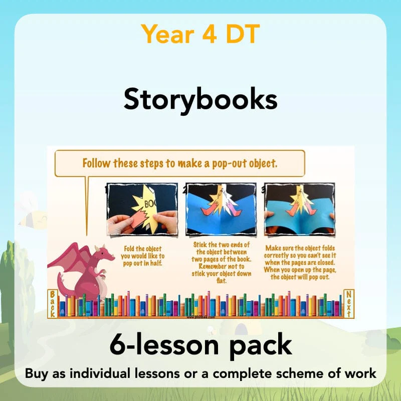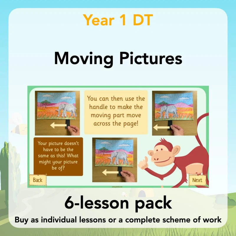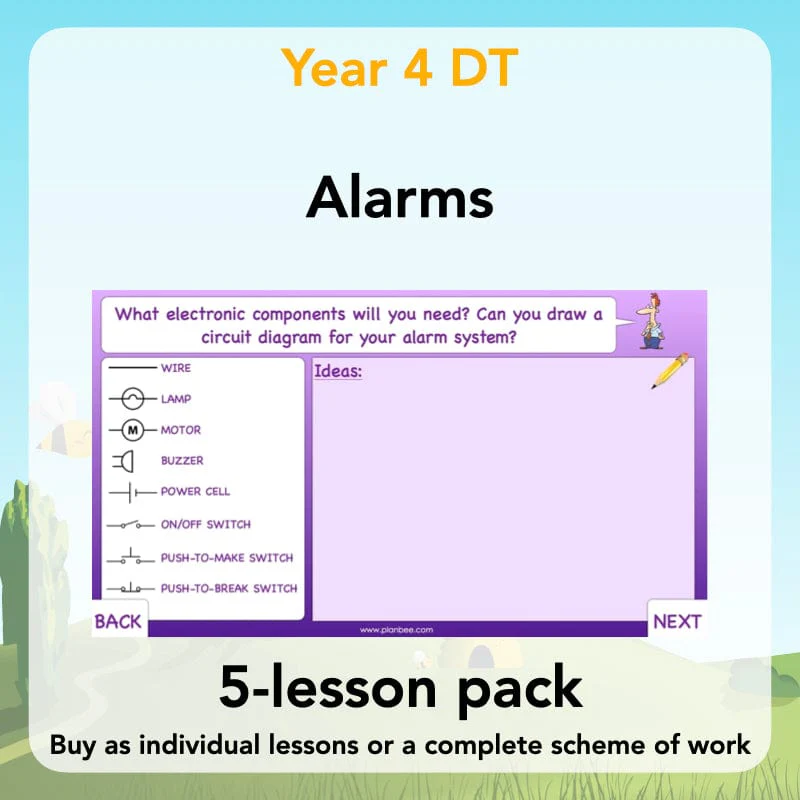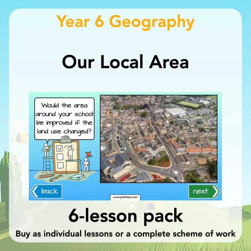
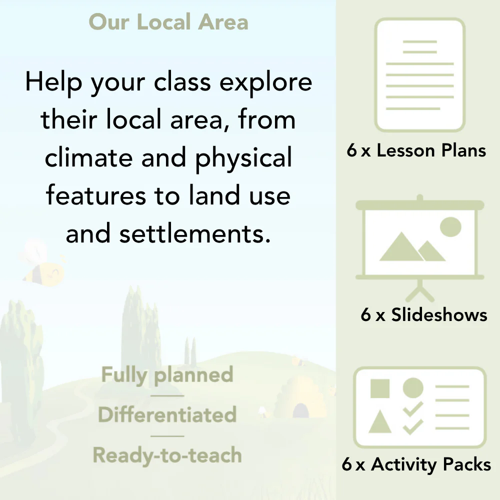
Our Local Area
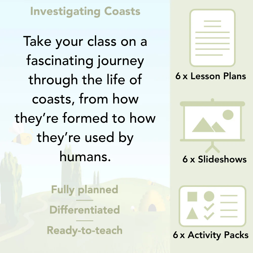
Find out about the human and physical features of your local area with this KS2 'Our Local Area' scheme of work for Year 6. This pack contains information about the UK's economic activity, land use, settlements, climate, upland areas and England's longest rivers which you can then link to your own local area, all through a set of detailed lesson plans, slideshows and printable resources.
Structured in a slightly different way to our other schemes of work due to the nature of the objectives (but still containing lesson plans, informative slides, differentiated worksheets, activity ideas and much more), these lessons allow you to choose the most relevant resources to suit your own local area. They will help your class to become more familiar with the human and physical geography of their locality and the UK as a whole. Please note: although the lessons are numbered, they can be taught in any order. This scheme of work is also part of a Topic Bundle. Perfect if you are teaching 'Me, Myself and I' as a cross-curricular topic.
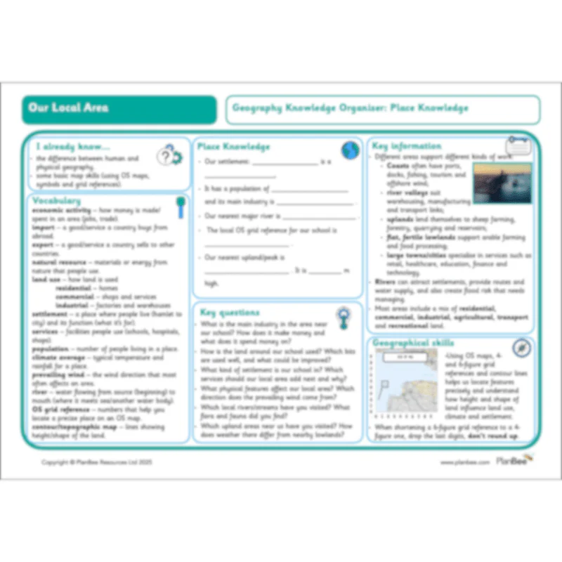
A Knowledge Organiser is available to support the learning in this scheme. It is included in the Complete Series download or can be purchased individually.
Why not upgrade to our Me, Myself and I Topic Bundle – perfect if you're looking for a cross-curricular approach to your teaching!
Human Features - Economic Activity
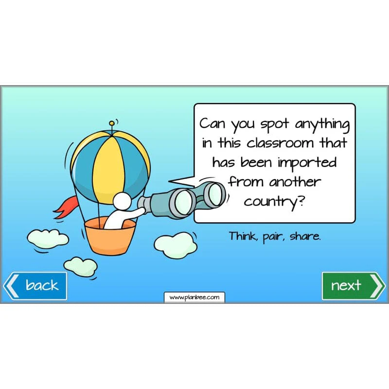
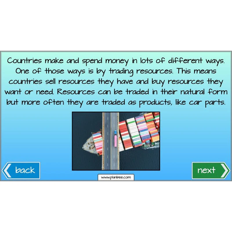
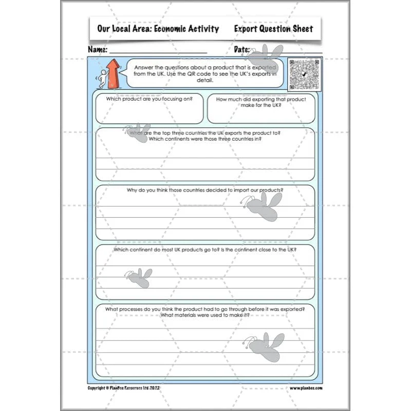
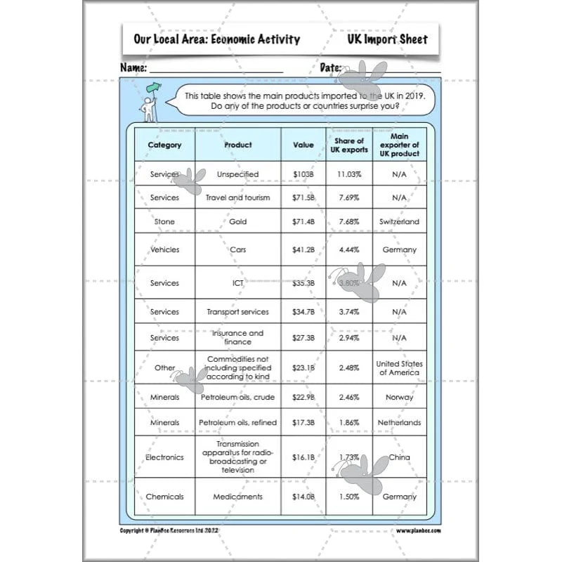
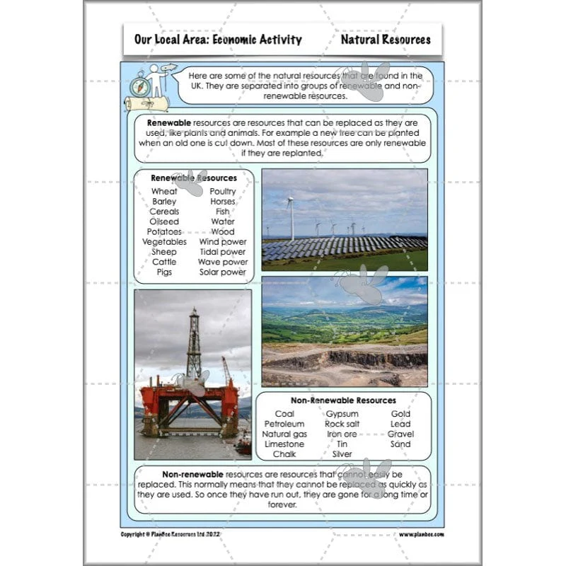
This section of the series teaches your class all about the UK's economic activity. During this lesson your class will look at the trade information for the UK and compare it to their local area. They will either track the journey of an imported or exported product, or they will visit a local area of industry to gain a better understanding of industries in their local area.
What's included:
- Lesson plan
- Slides
- Activity ideas
- Differentiated worksheets
- UK industries sheet
- Import and export sheets
- Import and export question sheets
- Site visit sheet
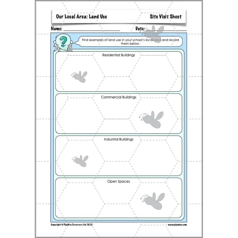
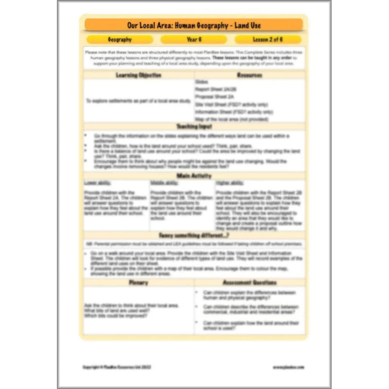
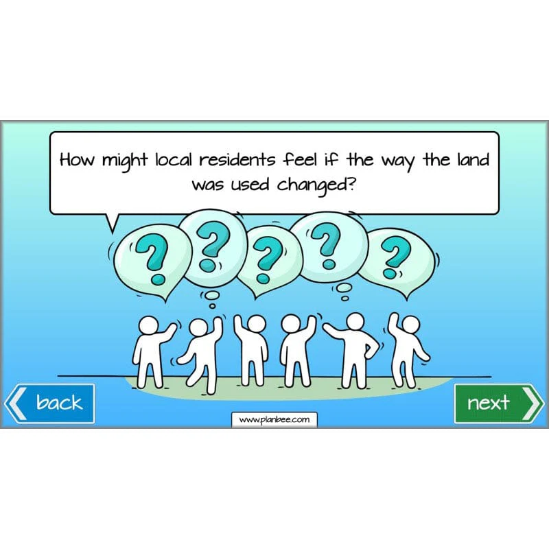
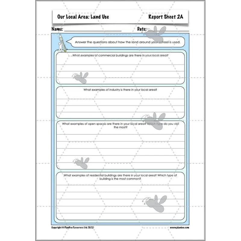
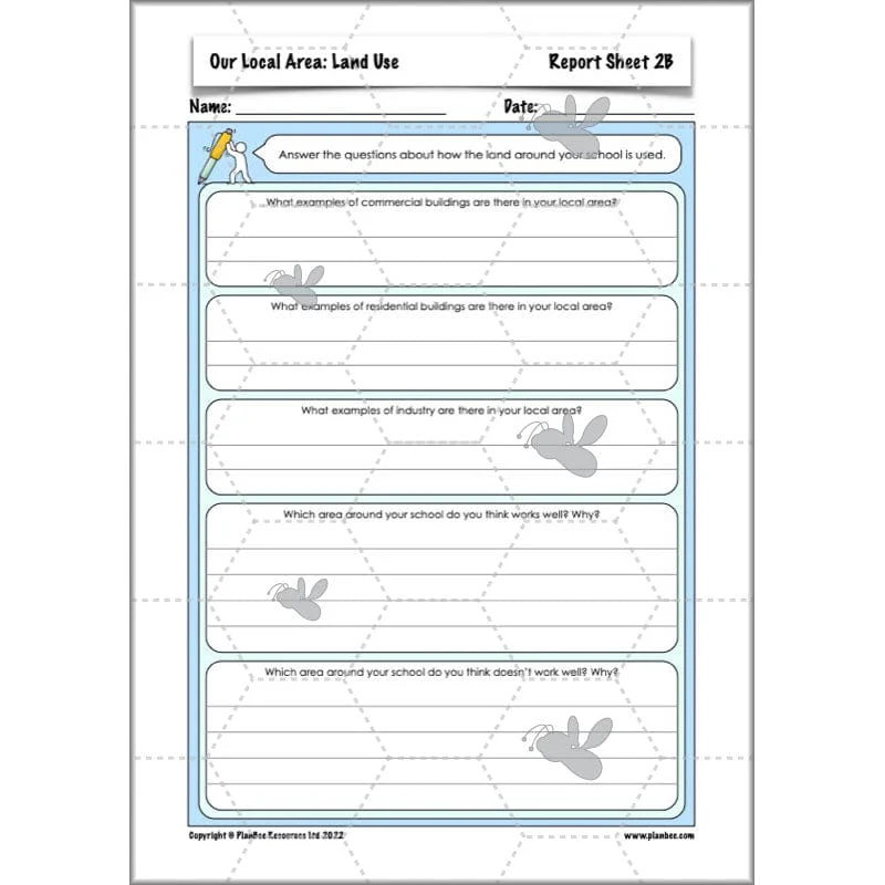
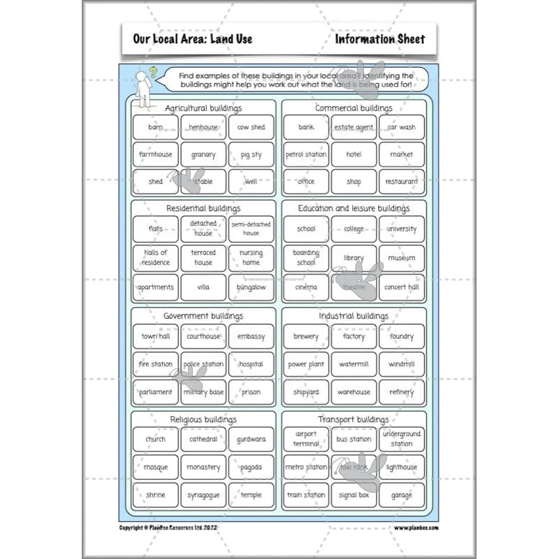
Human Features - Land Use
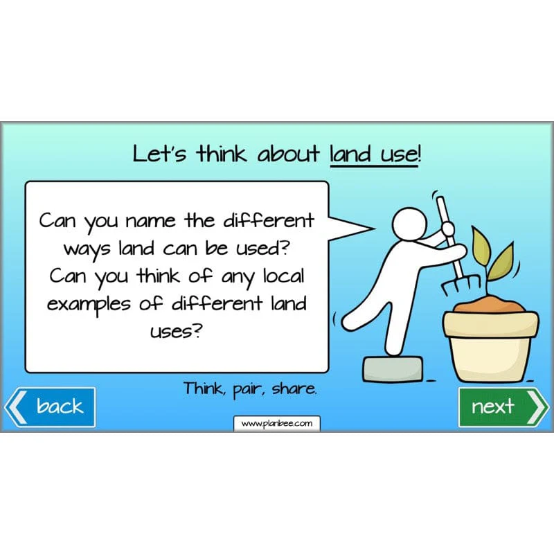
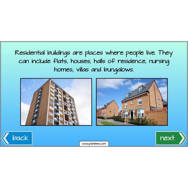
This section of the series teaches your class all about the different ways in which the UK's land is used. During this lesson your class will explore different ways the land is used in their local area and think about how changing the land use might affect the lives of the students at the school.
What's included:
- Lesson plan
- Slides
- Activity ideas
- Differentiated worksheets
- Report sheet
- Proposal sheet
- Information sheet
- Site visit sheet
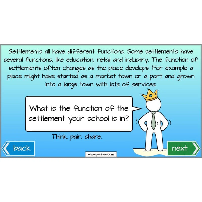
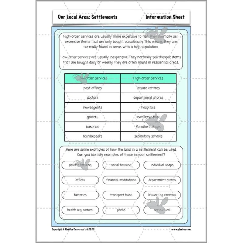
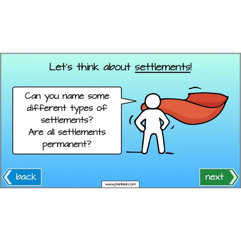
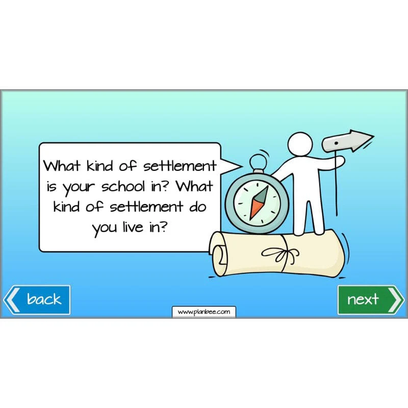
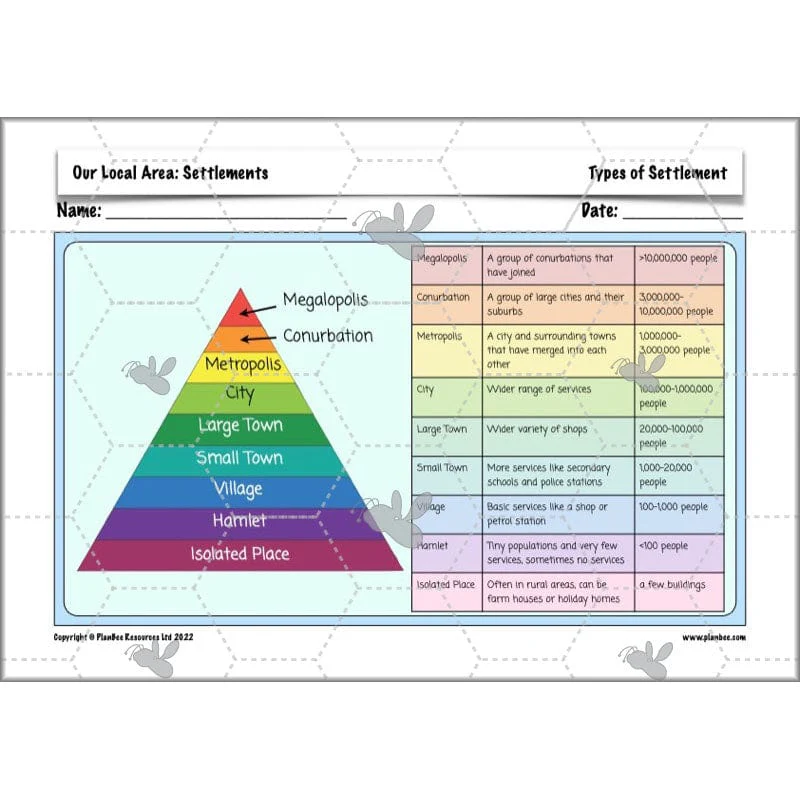
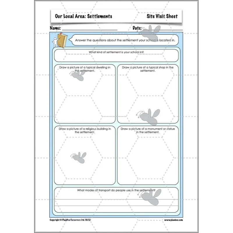
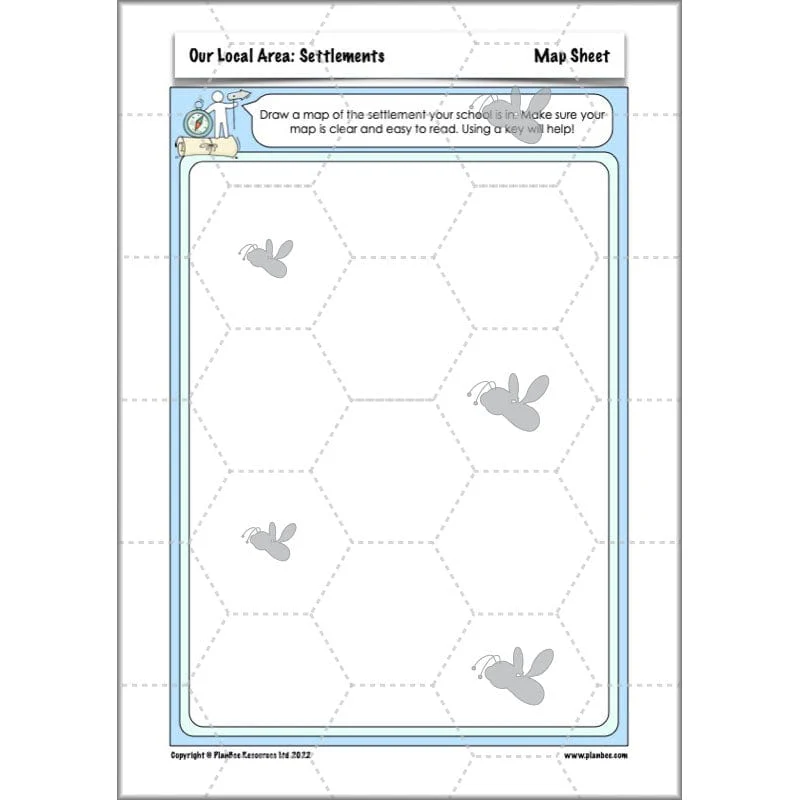
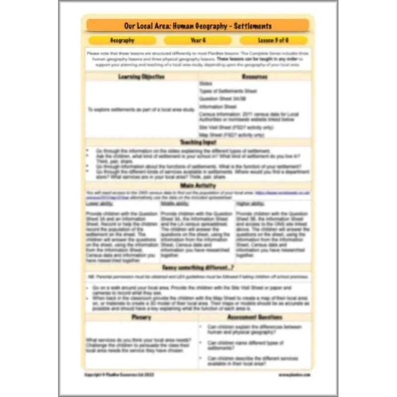
Human Features - Settlements
This section of the series teaches your class all about the different settlements found in the UK. During this lesson your class will find out about different kinds of settlements and think about what kind of settlement their school is in. They will have the opportunity to look at census information for their local settlement or create a model or a map of the area.
What's included:
- Lesson plan
- Slides
- Activity ideas
- Differentiated worksheet
- Types of settlements sheet
- Question sheets
- Information sheet
- Site visit sheet
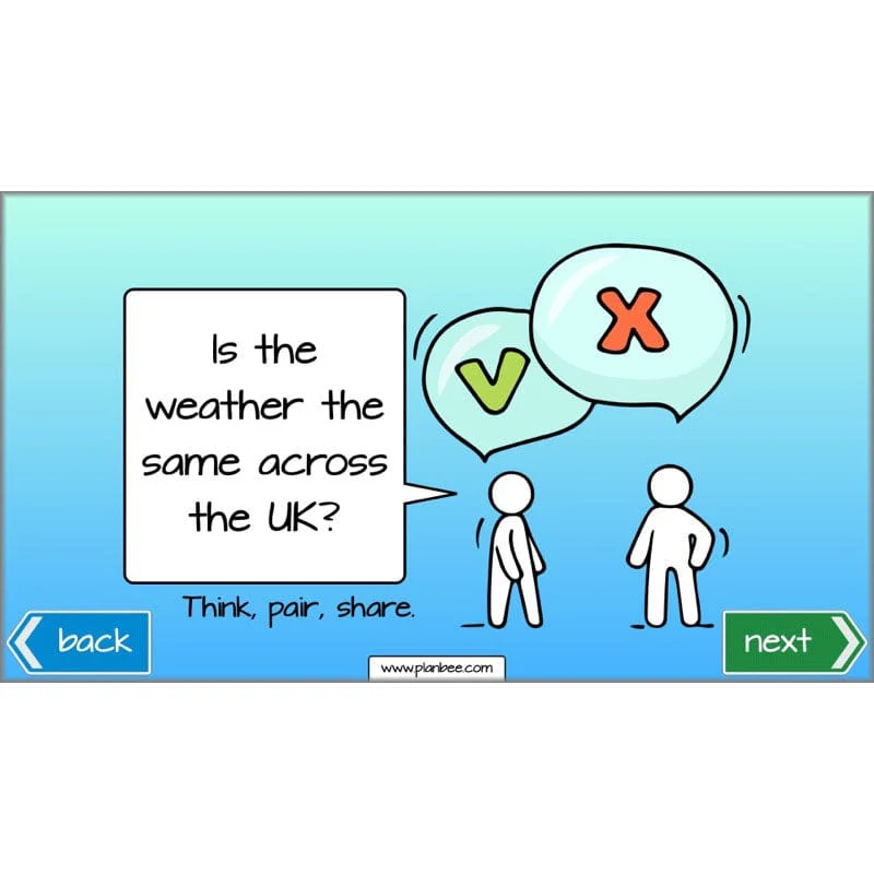
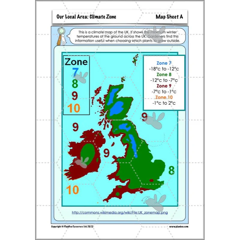
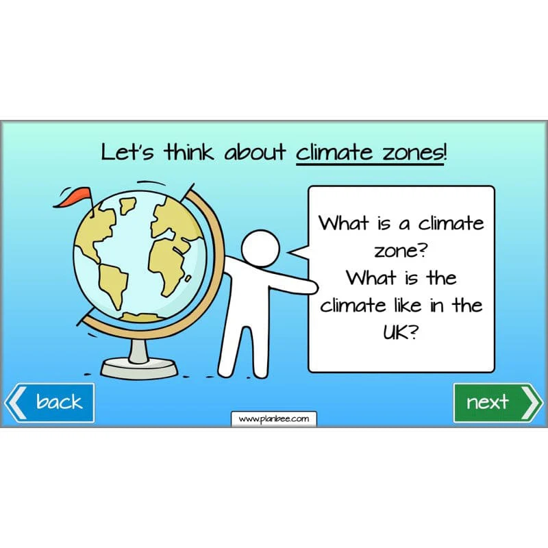
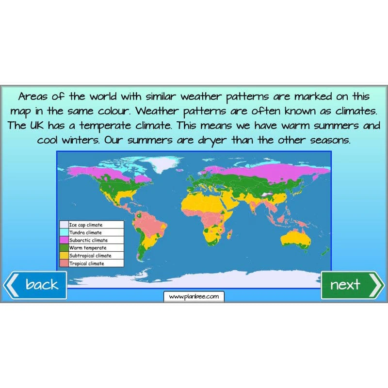
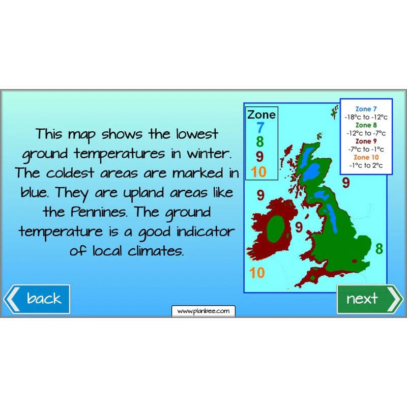
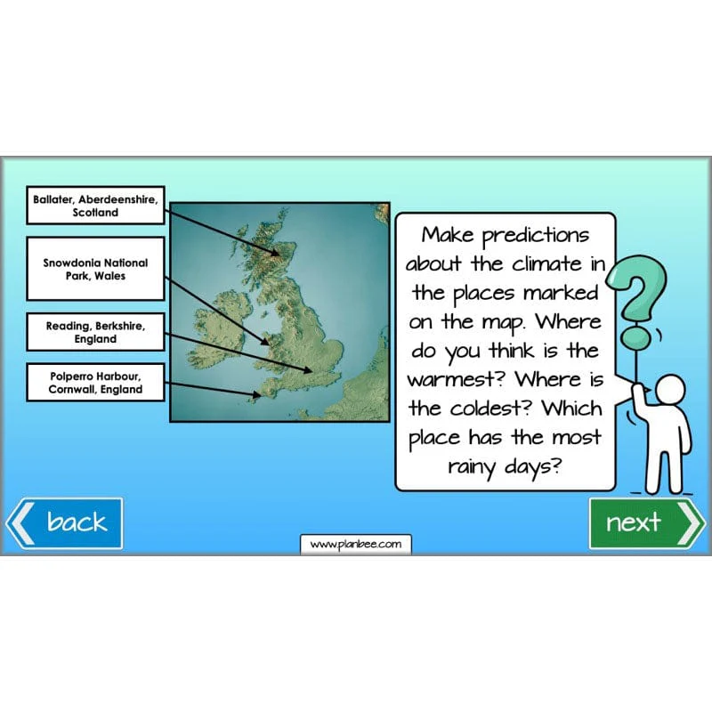
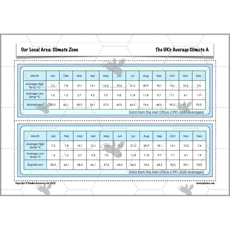
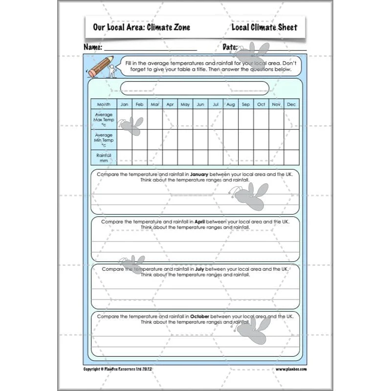
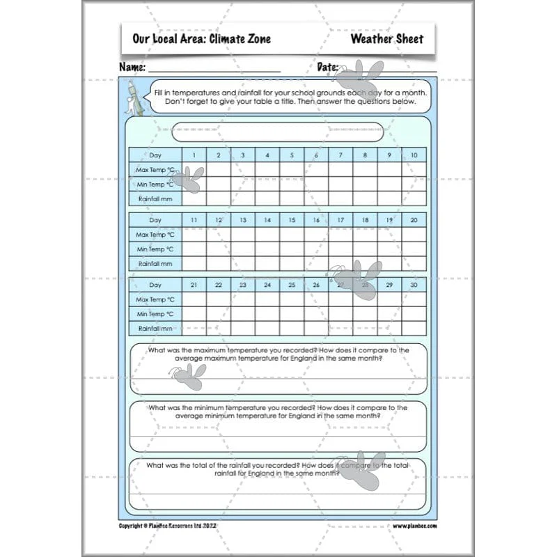
Physical Features - Climate Zone
This section of the series teaches your class all about the UK's climate, both relative to the rest of the world and the regional aspects of the climate. In this lesson your class will compare the local weather to the UK's average weather. Alternatively they can set up their own weather station to monitor the rainfall and temperature in their school playground.
What's included:
- Lesson plan
- Slides
- Activity ideas
- Differentiated worksheets
- Map sheets
- Average climate sheet
- Local climate sheet
- Weather sheet
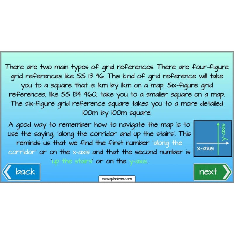
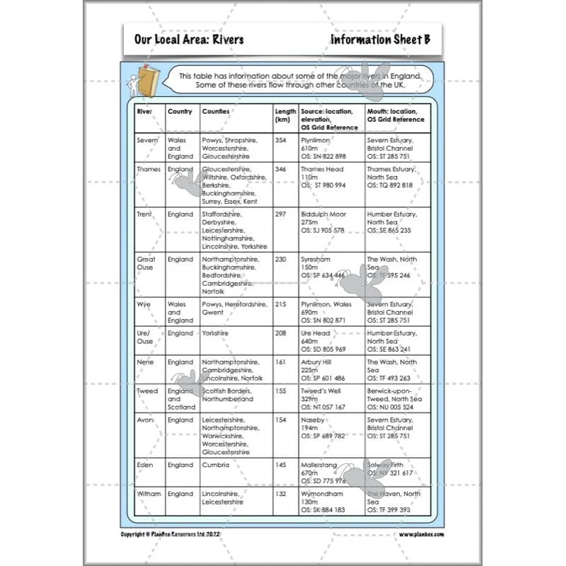
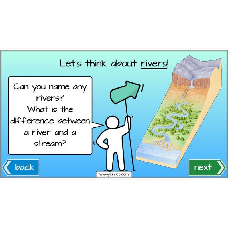
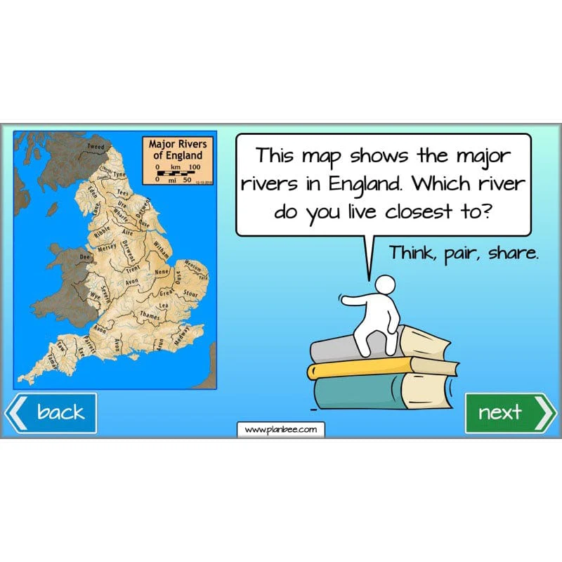
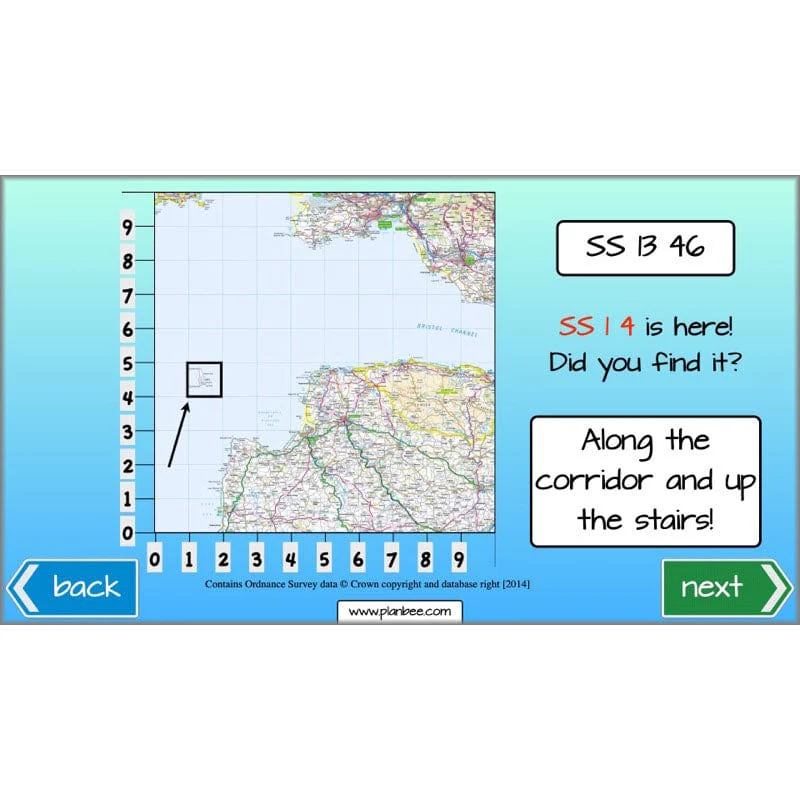
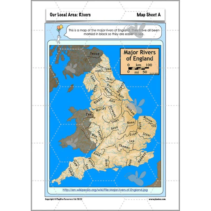
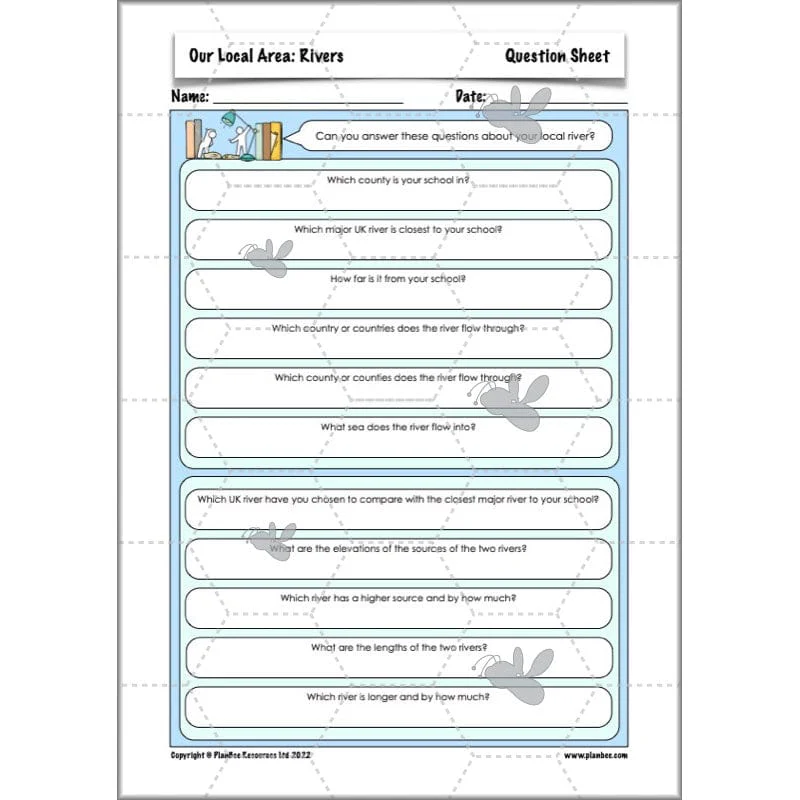
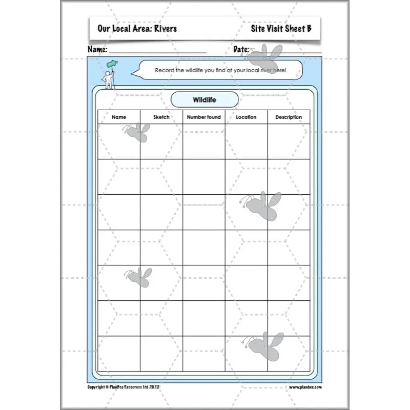
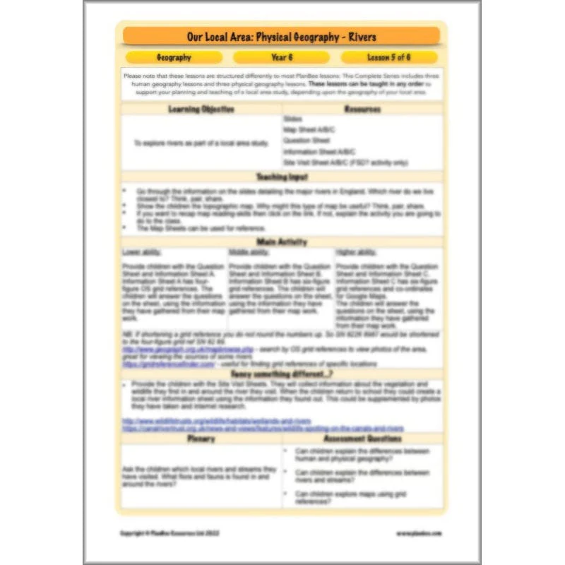
Physical Features - Rivers
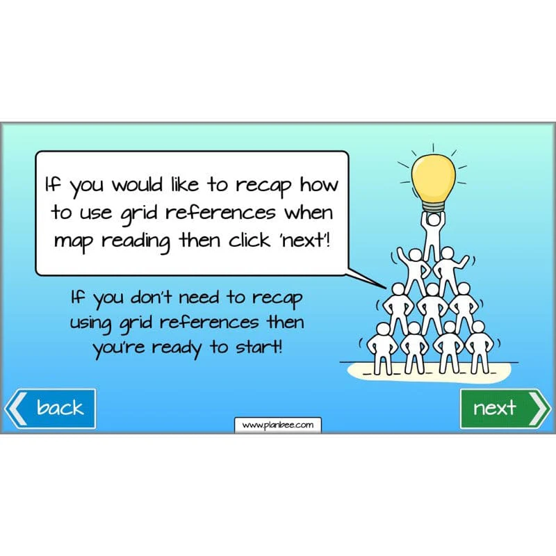
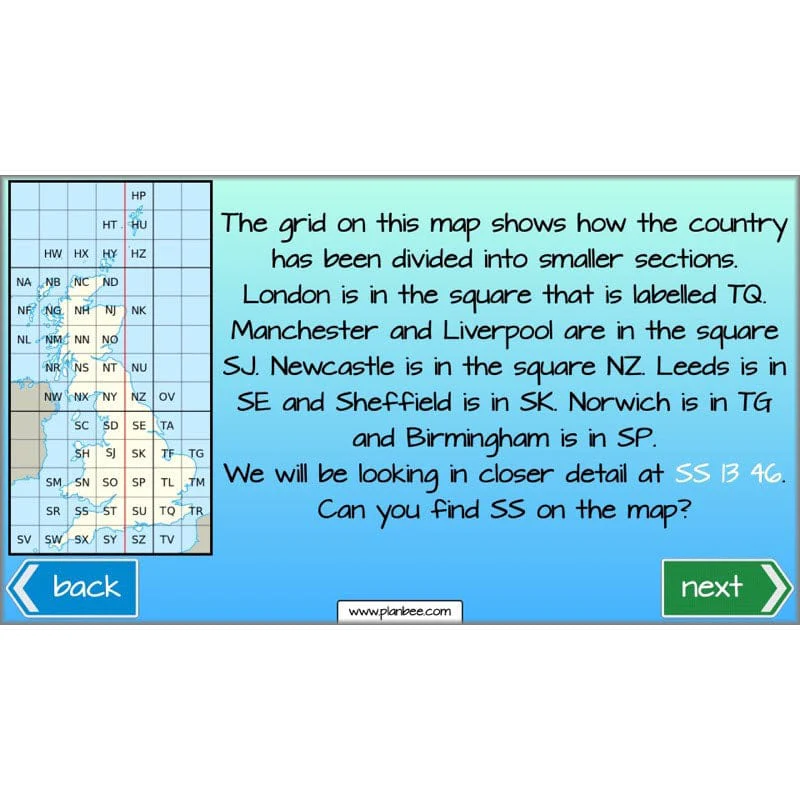
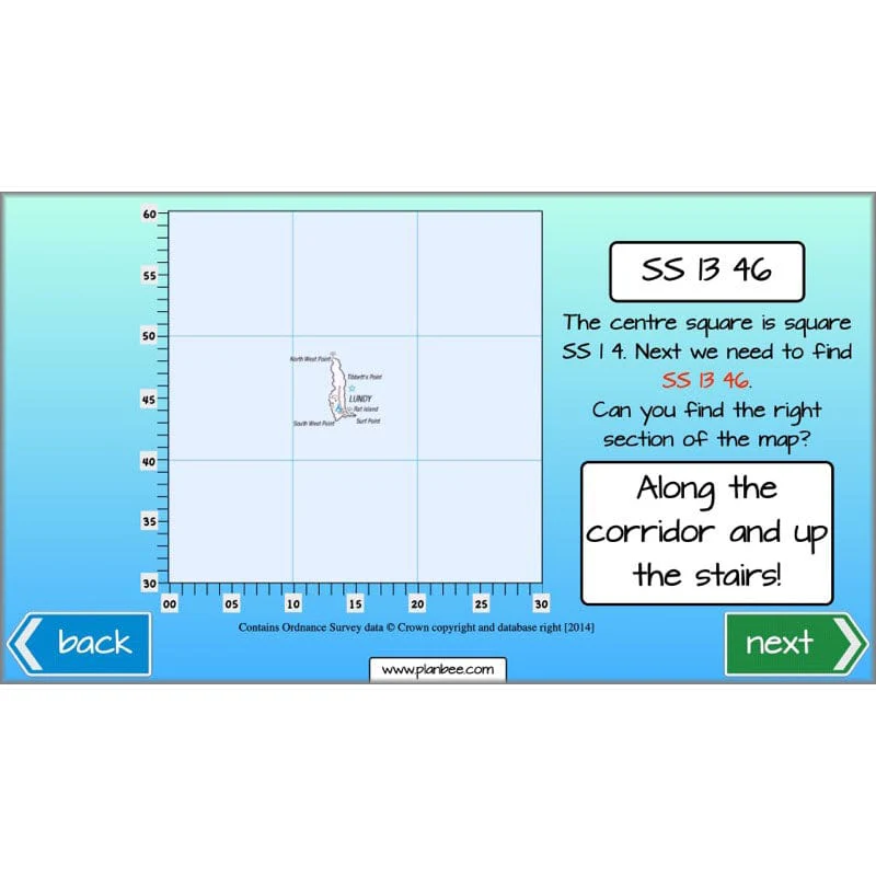
This section of the series teaches your class all about the longest rivers in England. In this lesson your class will be introduced to topographic maps and have the opportunity to develop their map reading skills. They will either use the provided information to find the source and the mouth of the closest rivers to them or alternatively they can visit a local river and collect information about the flora and fauna they find.
What's included:
- Lesson plan
- Slides
- Activity ideas
- Differentiated worksheets
- Map sheets
- Question sheet
- Information sheets
- Site visit sheets
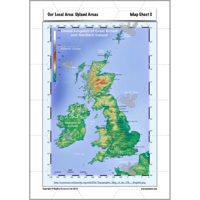
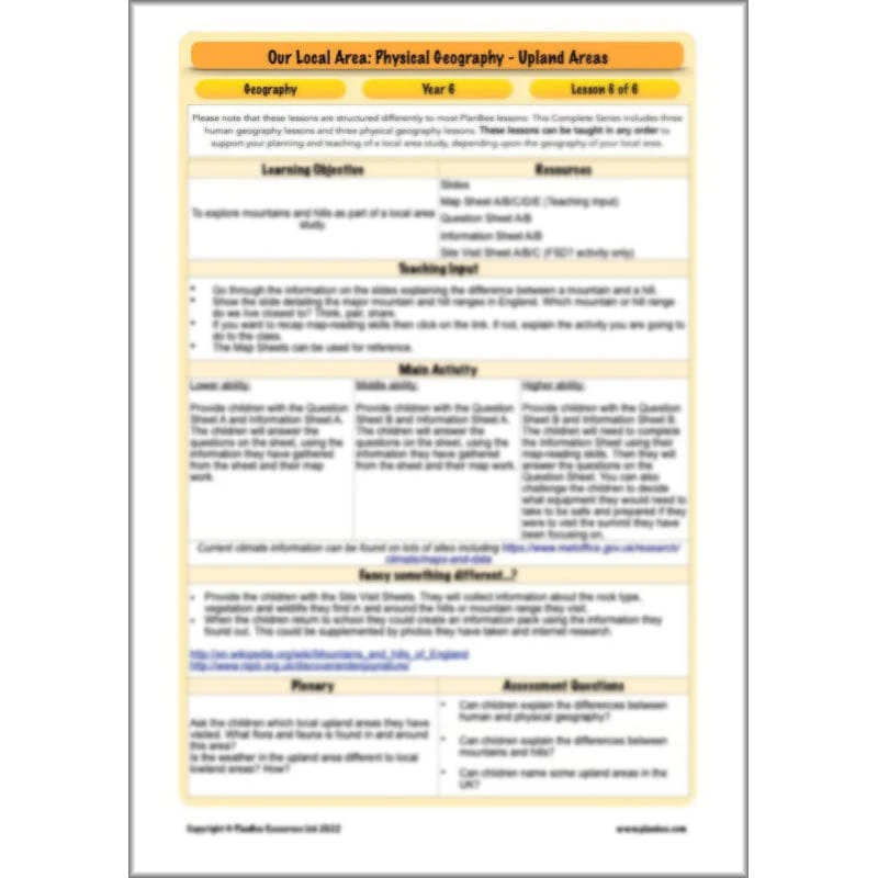
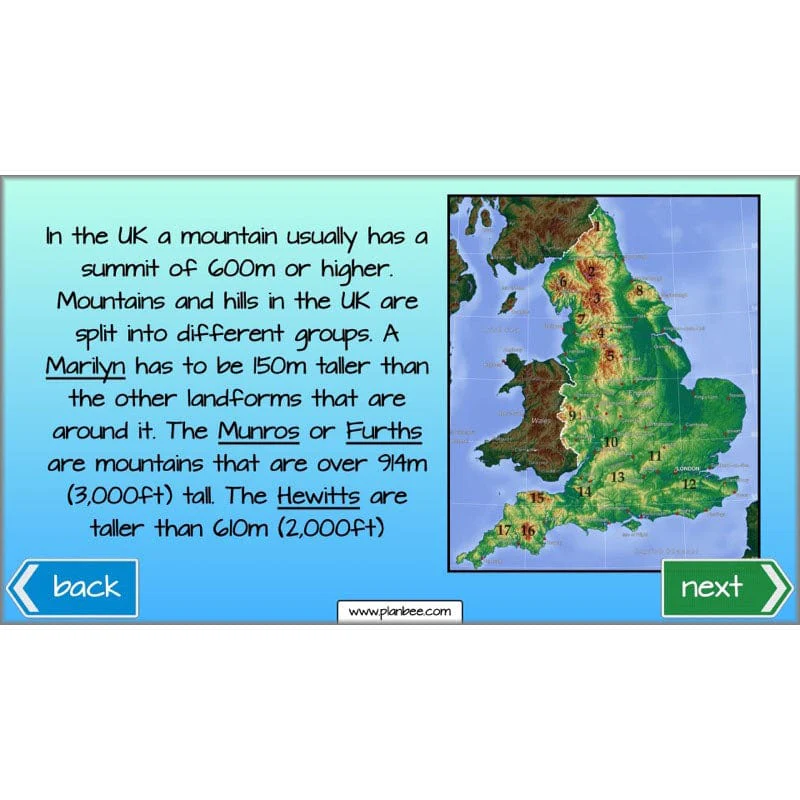
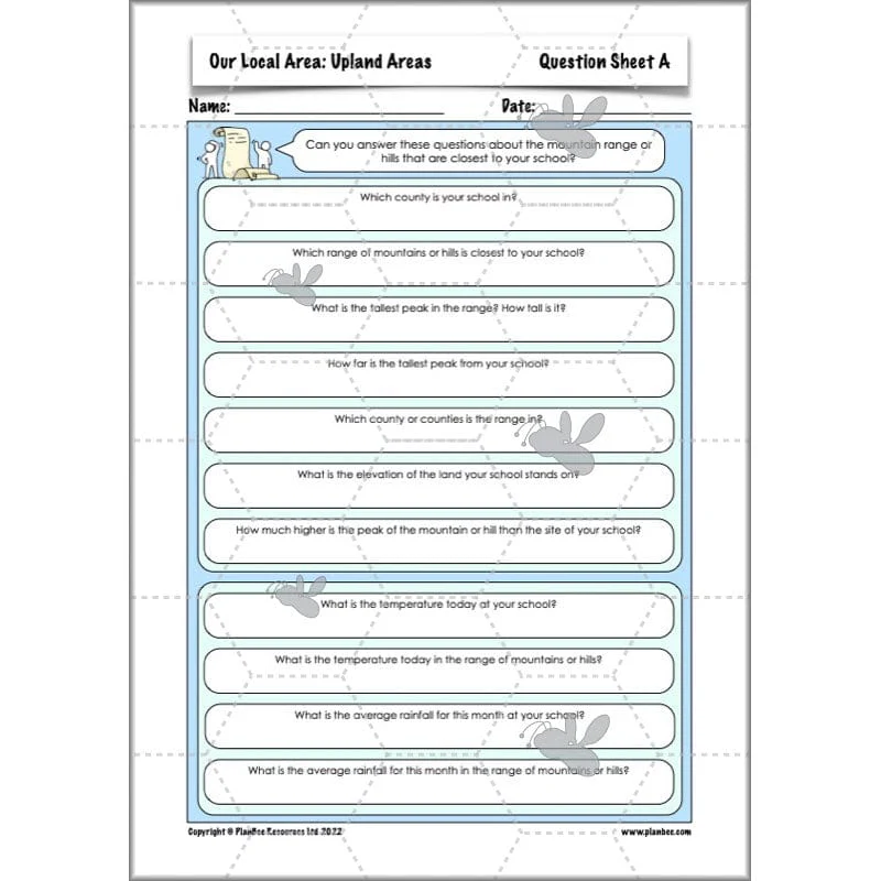
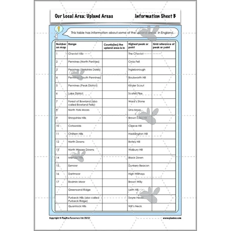
Physical Features - Upland Areas
This section of the series teaches your class all about upland areas in England. In this lesson your class will find out the difference between a mountain and a hill, as well as some of the different types of mountain. They will have the opportunity to develop their map reading skills when working out which upland area is closest to their school. Your class will also be encouraged to think about how the weather might be different at the summit of their nearest upland area and plan what they would need to wear or take if they were visiting it.
What's included:
- Lesson plan
- Slides
- Activity ideas
- Differentiated worksheets
- Map sheets
- Question sheets
- Information sheets
- Site visit sheets
This Year 6 Geography Knowledge Organiser has been created to complement our Geography Locational and Place Knowledge strand. It is designed to support your children’s understanding of key vocabulary linked to this scheme of work. Key questions and relevant geographical skills have been identified to encourage children to apply their knowledge around this topic.
Original: $1.99
-50%$1.99
$1.00More Images


Our Local Area
Find out about the human and physical features of your local area with this KS2 'Our Local Area' scheme of work for Year 6. This pack contains information about the UK's economic activity, land use, settlements, climate, upland areas and England's longest rivers which you can then link to your own local area, all through a set of detailed lesson plans, slideshows and printable resources.
Structured in a slightly different way to our other schemes of work due to the nature of the objectives (but still containing lesson plans, informative slides, differentiated worksheets, activity ideas and much more), these lessons allow you to choose the most relevant resources to suit your own local area. They will help your class to become more familiar with the human and physical geography of their locality and the UK as a whole. Please note: although the lessons are numbered, they can be taught in any order. This scheme of work is also part of a Topic Bundle. Perfect if you are teaching 'Me, Myself and I' as a cross-curricular topic.
A Knowledge Organiser is available to support the learning in this scheme. It is included in the Complete Series download or can be purchased individually.
Why not upgrade to our Me, Myself and I Topic Bundle – perfect if you're looking for a cross-curricular approach to your teaching!
Human Features - Economic Activity
This section of the series teaches your class all about the UK's economic activity. During this lesson your class will look at the trade information for the UK and compare it to their local area. They will either track the journey of an imported or exported product, or they will visit a local area of industry to gain a better understanding of industries in their local area.
What's included:
- Lesson plan
- Slides
- Activity ideas
- Differentiated worksheets
- UK industries sheet
- Import and export sheets
- Import and export question sheets
- Site visit sheet
Human Features - Land Use
This section of the series teaches your class all about the different ways in which the UK's land is used. During this lesson your class will explore different ways the land is used in their local area and think about how changing the land use might affect the lives of the students at the school.
What's included:
- Lesson plan
- Slides
- Activity ideas
- Differentiated worksheets
- Report sheet
- Proposal sheet
- Information sheet
- Site visit sheet
Human Features - Settlements
This section of the series teaches your class all about the different settlements found in the UK. During this lesson your class will find out about different kinds of settlements and think about what kind of settlement their school is in. They will have the opportunity to look at census information for their local settlement or create a model or a map of the area.
What's included:
- Lesson plan
- Slides
- Activity ideas
- Differentiated worksheet
- Types of settlements sheet
- Question sheets
- Information sheet
- Site visit sheet
Physical Features - Climate Zone
This section of the series teaches your class all about the UK's climate, both relative to the rest of the world and the regional aspects of the climate. In this lesson your class will compare the local weather to the UK's average weather. Alternatively they can set up their own weather station to monitor the rainfall and temperature in their school playground.
What's included:
- Lesson plan
- Slides
- Activity ideas
- Differentiated worksheets
- Map sheets
- Average climate sheet
- Local climate sheet
- Weather sheet
Physical Features - Rivers
This section of the series teaches your class all about the longest rivers in England. In this lesson your class will be introduced to topographic maps and have the opportunity to develop their map reading skills. They will either use the provided information to find the source and the mouth of the closest rivers to them or alternatively they can visit a local river and collect information about the flora and fauna they find.
What's included:
- Lesson plan
- Slides
- Activity ideas
- Differentiated worksheets
- Map sheets
- Question sheet
- Information sheets
- Site visit sheets
Physical Features - Upland Areas
This section of the series teaches your class all about upland areas in England. In this lesson your class will find out the difference between a mountain and a hill, as well as some of the different types of mountain. They will have the opportunity to develop their map reading skills when working out which upland area is closest to their school. Your class will also be encouraged to think about how the weather might be different at the summit of their nearest upland area and plan what they would need to wear or take if they were visiting it.
What's included:
- Lesson plan
- Slides
- Activity ideas
- Differentiated worksheets
- Map sheets
- Question sheets
- Information sheets
- Site visit sheets
This Year 6 Geography Knowledge Organiser has been created to complement our Geography Locational and Place Knowledge strand. It is designed to support your children’s understanding of key vocabulary linked to this scheme of work. Key questions and relevant geographical skills have been identified to encourage children to apply their knowledge around this topic.
Product Information
Product Information
Shipping & Returns
Shipping & Returns
Description
Find out about the human and physical features of your local area with this KS2 'Our Local Area' scheme of work for Year 6. This pack contains information about the UK's economic activity, land use, settlements, climate, upland areas and England's longest rivers which you can then link to your own local area, all through a set of detailed lesson plans, slideshows and printable resources.
Structured in a slightly different way to our other schemes of work due to the nature of the objectives (but still containing lesson plans, informative slides, differentiated worksheets, activity ideas and much more), these lessons allow you to choose the most relevant resources to suit your own local area. They will help your class to become more familiar with the human and physical geography of their locality and the UK as a whole. Please note: although the lessons are numbered, they can be taught in any order. This scheme of work is also part of a Topic Bundle. Perfect if you are teaching 'Me, Myself and I' as a cross-curricular topic.
A Knowledge Organiser is available to support the learning in this scheme. It is included in the Complete Series download or can be purchased individually.
Why not upgrade to our Me, Myself and I Topic Bundle – perfect if you're looking for a cross-curricular approach to your teaching!
Human Features - Economic Activity
This section of the series teaches your class all about the UK's economic activity. During this lesson your class will look at the trade information for the UK and compare it to their local area. They will either track the journey of an imported or exported product, or they will visit a local area of industry to gain a better understanding of industries in their local area.
What's included:
- Lesson plan
- Slides
- Activity ideas
- Differentiated worksheets
- UK industries sheet
- Import and export sheets
- Import and export question sheets
- Site visit sheet
Human Features - Land Use
This section of the series teaches your class all about the different ways in which the UK's land is used. During this lesson your class will explore different ways the land is used in their local area and think about how changing the land use might affect the lives of the students at the school.
What's included:
- Lesson plan
- Slides
- Activity ideas
- Differentiated worksheets
- Report sheet
- Proposal sheet
- Information sheet
- Site visit sheet
Human Features - Settlements
This section of the series teaches your class all about the different settlements found in the UK. During this lesson your class will find out about different kinds of settlements and think about what kind of settlement their school is in. They will have the opportunity to look at census information for their local settlement or create a model or a map of the area.
What's included:
- Lesson plan
- Slides
- Activity ideas
- Differentiated worksheet
- Types of settlements sheet
- Question sheets
- Information sheet
- Site visit sheet
Physical Features - Climate Zone
This section of the series teaches your class all about the UK's climate, both relative to the rest of the world and the regional aspects of the climate. In this lesson your class will compare the local weather to the UK's average weather. Alternatively they can set up their own weather station to monitor the rainfall and temperature in their school playground.
What's included:
- Lesson plan
- Slides
- Activity ideas
- Differentiated worksheets
- Map sheets
- Average climate sheet
- Local climate sheet
- Weather sheet
Physical Features - Rivers
This section of the series teaches your class all about the longest rivers in England. In this lesson your class will be introduced to topographic maps and have the opportunity to develop their map reading skills. They will either use the provided information to find the source and the mouth of the closest rivers to them or alternatively they can visit a local river and collect information about the flora and fauna they find.
What's included:
- Lesson plan
- Slides
- Activity ideas
- Differentiated worksheets
- Map sheets
- Question sheet
- Information sheets
- Site visit sheets
Physical Features - Upland Areas
This section of the series teaches your class all about upland areas in England. In this lesson your class will find out the difference between a mountain and a hill, as well as some of the different types of mountain. They will have the opportunity to develop their map reading skills when working out which upland area is closest to their school. Your class will also be encouraged to think about how the weather might be different at the summit of their nearest upland area and plan what they would need to wear or take if they were visiting it.
What's included:
- Lesson plan
- Slides
- Activity ideas
- Differentiated worksheets
- Map sheets
- Question sheets
- Information sheets
- Site visit sheets
This Year 6 Geography Knowledge Organiser has been created to complement our Geography Locational and Place Knowledge strand. It is designed to support your children’s understanding of key vocabulary linked to this scheme of work. Key questions and relevant geographical skills have been identified to encourage children to apply their knowledge around this topic.